It’s January. After a quiet winter so far, it shouldn’t be surprising that we’re actually going to get some snow and ice. Yes, we’ll see some problems, but we’re from the Region–we can handle this.
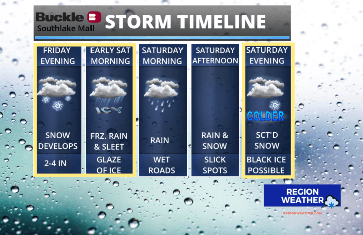
A smorgasbord of precipitation is heading our way with our well-advertised storm system that will impact a large majority of the eastern US. It all begins this evening with a period of moderate snow.
That snow will change to a mix of sleet and freezing rain overnight before turning to all rain during the morning hours Saturday as warm air briefly moves into the Region.

The worst travel conditions are expected this evening through the early morning hours Saturday. In terms of snow, we’re still expected 2-4 inches with highest totals the further north you’re located.

We’re likely to see a brief period of sleet as we mentioned:

Freezing rain is also likely during the early morning hours Saturday. This could be enough to create a glaze until temps warm above freezing. Important to keep an eye on your car thermometer if you’re out and about Saturday morning. If the temp is around freezing or lower–and it’s raining–that is freezing rain. Look at the extent of the ice around the Ohio Valley!

The impact won’t just be felt here in the Region–if you have travel plans anywhere around the Midwest, Missouri Valley, or Ohio Valley, you’ll have problems. Thankfully this is on a Friday night into a Saturday morning.

Finally, here’s a look at what we can expect locally: