Good morning to our Region Weather email family! You’re probably sick of hearing about today’s well advertised severe weather threat, but it’ll be here in a matter of hours. Overnight, models have shifted a bit further south with the worst of the storms–this is good news for the Region, but we’ll still have a high chance at severe weather today.
First things first. Today’s storms will be fast movers and our atmosphere will lead to some rapid storm development and rapidly changing conditions. We’ll start with the summary before diving into the details:
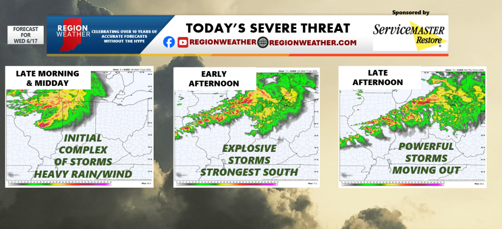
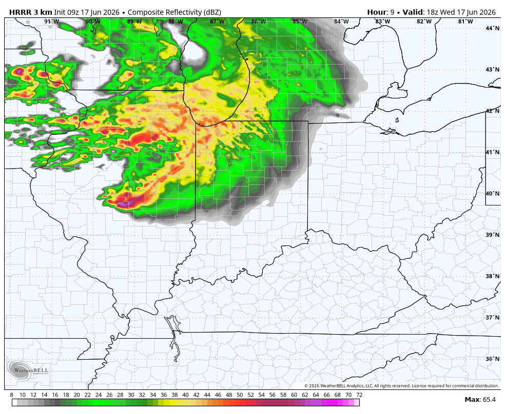
MORNING-MIDDAY: Clouds increase and soaking rain and storms move in late morning into midday. Heavy rain and flooding possible as complex lingers over the Region through early afternoon. Severe weather is possible with this batch, damaging winds being the primary threat.
MORNING ROUND:
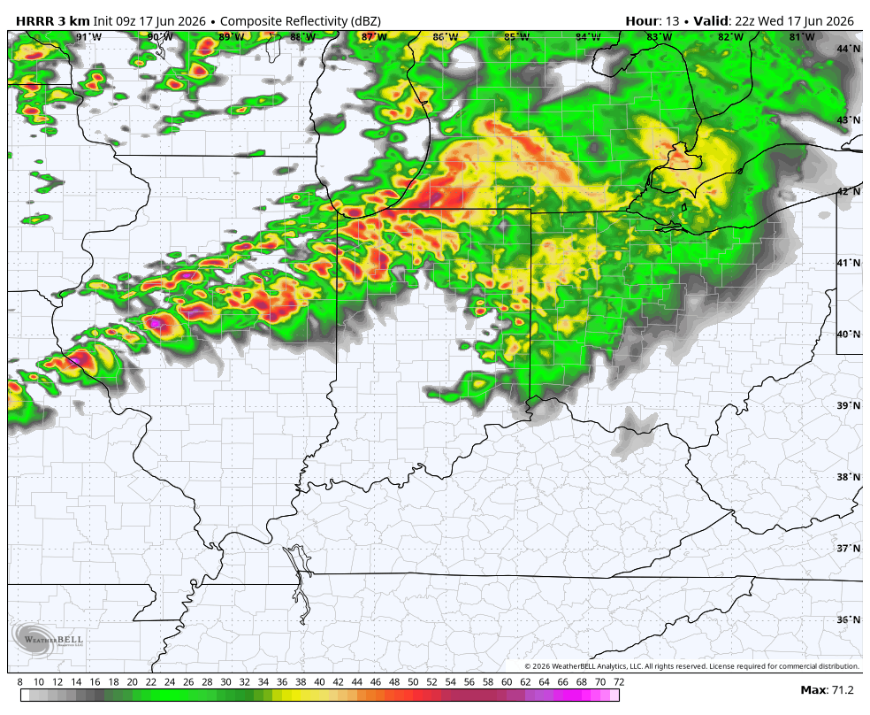
EARLY AFTERNOON: Complex of storms will likely linger as cold front approaches. The cold front will pop additional storms–we not get much of a break if any as the rain continues. These storms that pop along the cold front have the highest severe threat with all modes of severe weather possible. However, the highest threat for tornadoes will be where the warm front parks itself (as we discussed in detail in our LIVE broadcast last evening). This front will likely settle south of us, or in our southern counties. The further south you’re located, the higher the risk of a tornado with these afternoon storms.
EARLY AFTERNOON ROUND:
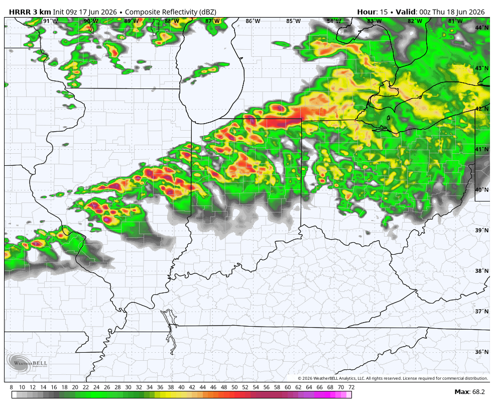
LATE AFTERNOON: The final line of storms that develops early afternoon will be pushing out and we’ll quickly go severe weather clear this evening.
LATE AFTERNOON ROUND:
Now for the details if you’re interested:
Overnight, models continued to push the real nasty portion of this storm system further SOUTH, which isn’t a surprise. We’ve been talking about this possibility due to the “cold pool” of air from our morning/midday storms pushing the front south. As we discussed in our LIVE broadcast last night, this low is very strong for this time of year, so models don’t handle that well. That being said, we’re going to need to keep a close eye on the exact position of the warm front and where it ends up. Why? Because that front will be the dividing line between the threat for tornadic supercells (south of the front and along it) and more of a heavy rain, damaging wind threat to the north of the front.
Our overall threat is indeed lower this morning, which is great news! But given how strong this low is, we can’t let our guard down as this system blows through today. Make sure you have a way to get warnings and we’ll keep you updated as we go throughout the day as you’d expect on our YouTube Channel and Facebook Page including LIVE coverage as needed.