Hi everyone, wanted to pass along an update on our severe weather now that we’re getting into the lunchhour!
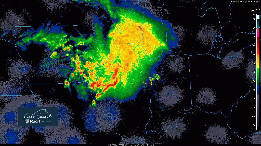
Our initial giant storm complex continues to SOAK the Region with steady moderate to heavy rain as severe weather continues well south of us. We’ll continue with this heavier rain over the next hour or so before we begin to transition to more on and off downpours as the entire complex moves to the east.
This is when we’ll watch what happens to the warm front which has been pushed well south of us! Remember, south of the warm front is where the nasty storms will be today–we want it to stay to our south! It should start it’s northward progression while at the same time we watch the cold front push in from the northwest–helping to spark additional storms this afternoon. Most models agree this warm front stays JUST south of the Region, but as we mentioned yesterday, this strong low may do the unthinkable and bring it closer than models show–hopefully not.
If the front DOES stay south, we’ll likely still see storms this afternoon with a damaging wind risk, but the bigger tornado threat would more than likely stay away from us. We’ll continue to closely monitor and will keep you updated.
Midday Radar Loop: