SEVERE T’STORM WATCH UNTIL 10PM CT
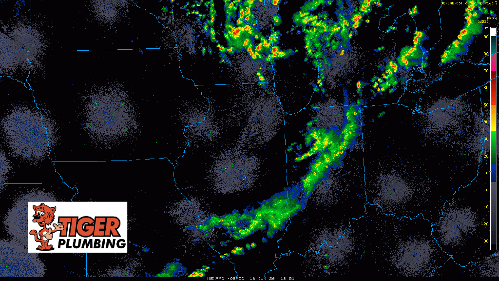
Today’s cold front is moving through as we speak and we are on the very western end of the newly issued Severe T’Storm Watch that encompasses all of northern Indiana. We’re just now seeing storms blossom in Lake County and just to the west of Newton County–and while they’re small now, there is expected to be pretty rapid growth to these. The good news is, these will be out of here quickly and our severe threat will be completely over the rest of the day. However, we’ll have to watch these storms are they develop over the next hour over us–primary risk is for some pockets of strong wind to develop. Our overall threat remains low compared to the rest of the state.
Attention then turns towards Wednesday’s much bigger severe threat. We’ll do a LIVE broadcast later this evening to discuss everything.