SEVERE WEATHER OUTBREAK LIKELY WEDNESDAY
You know we’re not big fans of hype. We’ve never hyped a forecast for clicks and never will. This one, however, deserves the hype on Wednesday. Wednesday’s severe weather setup is off the charts on most modeling with a near record-setting low pressure for the month of June, powerful winds at the low, mid, and upper levels of our atmosphere, and a setup that allows for explosive supercells across Illinois and Indiana. This is the LAST thing we need locally as we continue to clean up from our tornado outbreak last week.
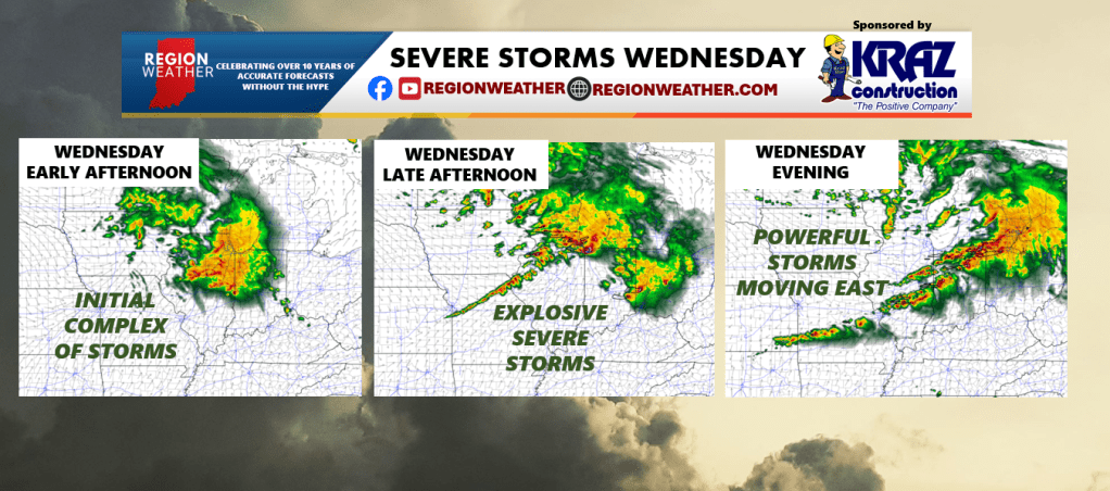
We’ll be doing a Facebook LIVE broadcast later this evening, but until then, here’s the initial setup we’re looking at. A large complex of storms may form and roll through Wednesday morning-early afternoon. There would be a severe risk with this, although not high, and damaging winds would be the primary threat if/when it moves through the Region.
We would then see a powerful cold front with the strong low pressure push towards the Region. Storms would explode along and ahead of this boundary bringing severe storms through the Region during the afternoon-evening Wednesday. All modes of severe weather can be expected with this round including strong, long-track tornadoes. There are still plenty of details that need ironed out and yes, some of those details could squash a higher end severe threat–but what I’m seeing now is impressive and we’ll need to really pay attention to these upcoming forecasts as new model guidance is released. Our severe threat would quickly end Wednesday night.
More to come.