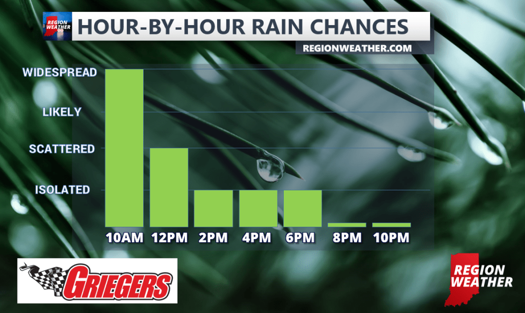
Another morning and another round of heavy rain and storms–this will be our last organized round and will move out later this morning. The cold front is still well to our north in northern Illinois draped back towards Iowa so until that front passes through, we’ll run the risk of additional pop-up downpours through afternoon. As you know, we’ve made up quite a bit towards our rainfall deficit this weekend, but the rainfall ranges widely as you’d expect in the summer. Some spots have seen an inch whereas others have picked up over 4 inches of rain this weekend with the highest totals coming out of Newton County and then in the northern Porter and LaPorte County areas.