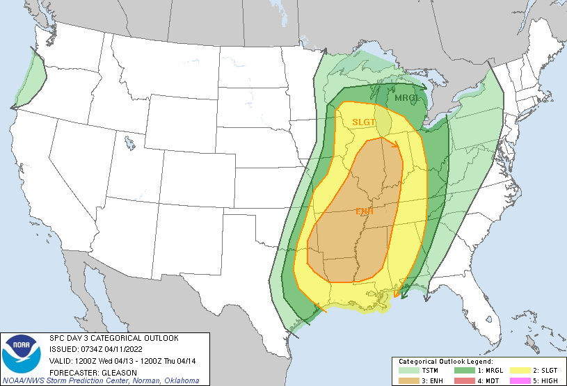
We’re continuing to watch for the threat of severe thunderstorms, not just across a large portion of the US the next two days, but locally as well. As we discussed in our Region Weather LIVE broadcast last night, the Wednesday-Wednesday night will pose the highest risk for us locally with all modes of severe weather (damaging wind, hail, few tornadoes) possible as that strong spring cold front moves in. We’re on it and will have a special Region Weather LIVE Tuesday evening to discuss as well as coverage throughout the day Wednesday as needed.