
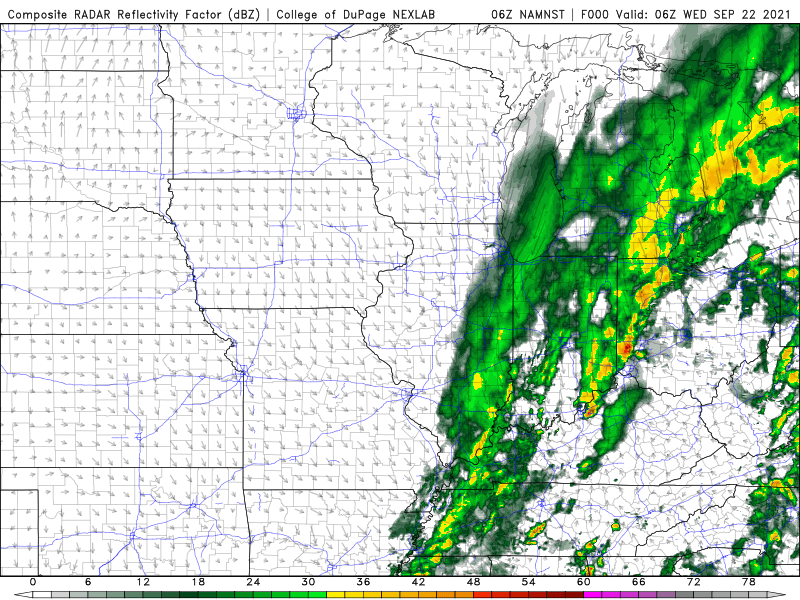
The first day of Fall begins with a powerful storm system that will really get going later today and tonight across the southern Great Lakes bringing rain back into the Region along with strong winds. Here’s what the evolution of this storm system will likely look like on radar as the low strengthens and swirls through Ohio and eastern Michigan:
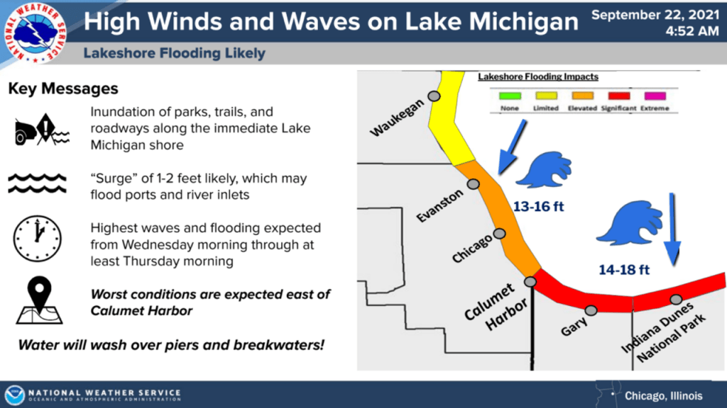
These winds will align perfectly with the length of the lake helping to push wave heights into the 10-18 foot range. Those that live in and around the lakeshore know the drill–lakeshore flooding and erosion is likely over the next 48 hours.
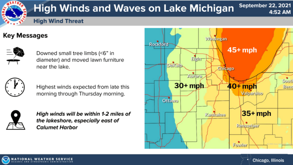
As mentioned, the winds will become quite gusty as this low pressure system deepens to our east. Gusts will be strongest along the lakeshore as they blow off the relatively frictionless lake. Further inland we’ll still see stronger gusts, but the lakeshore will take the brunt of this storm.
Rain will also spiral back into the Region later today with waves of showers and even some lake effect rain expected as the cooler air filters over our warm lake waters. We should quickly clear out on the backside of this storm system with sunshine returning Friday and warmer temps to follow!
Here’s our forecast for the next 3 days:

