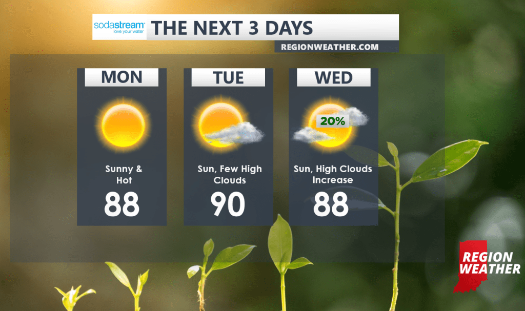
A large, and I mean LARGE dome of high pressure will edge into the Region from the southwest over the next few days. While we’ll be on the periphery of the ridge, we’ll tap into some typical summer-time warmth. Highs will approach 90 and combined with the humidity, it will feel more like the mid to upper 90s at times.
Storm chances will be on-going to our north and we’ll have to keep a close eye on the potential for any of these larger clusters of storms to sink south. For now, we’ll keep the forecast dry through Wednesday with decent storm chances returning Thursday with a frontal boundary. Stay hydrated folks!