
After a morning round of showers and storms (the leftovers of last nights complex of storms to our north) we’ll deal with some lingering pop-up downpours chances this afternoon, otherwise a mix of sun and clouds is expected. We’ll be hot with highs well into the 80s. Combined with the humidity, we’ll feel more like the mid 90s this afternoon)
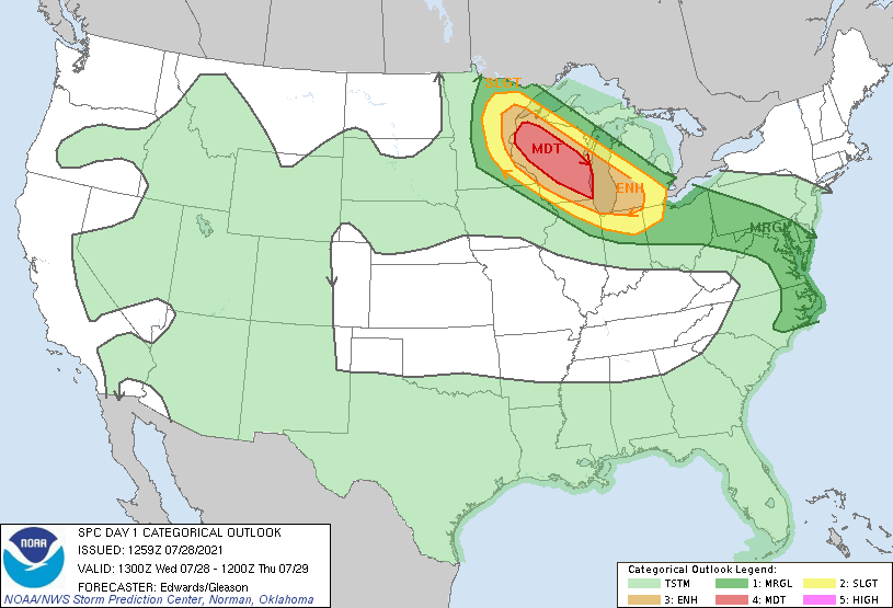
Attention then turns to our well-advertised complex of storms that we’re expecting to rapidly develop in Wisconsin and eastern Minnesota late this afternoon. This complex of storms is expected to quickly go severe as it rides southeast along an axis of the heat to the west and the cooler air to the east. You can see the severe threats as outlined by the Storm Prediction Center:
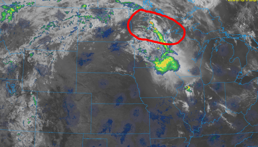
As of midday, there is already on-going convection in northern Wisconsin and Minnesota, but the stronger activity hasn’t developed yet and will likely wait until the peak heating of the day to do so. (the circled area is where we expect the complex of storms to fire up)
This complex of storms will quickly move southeast across Wisconsin towards Lake Michigan and eventually towards northern Indiana very late this evening into the overnight. Damaging winds are very likely with the potential for this cluster of storms to develop into a derecho.
The biggest question as of this post (midday Wednesday) is where the exact track of the complex ends up going as the leading edge of its path will have the biggest damaging wind potential. Because it hasn’t developed yet, all of NWI is in play, but the strongest part of this complex of storms will be right in the center of wherever it tracks.
The early afternoon guidance suggests this may be just to our east, but on the counter side, there is still some lingering guidance that keeps it west. Once it develops, we’ll have a better handle on the exact track and the local impacts to NWI.
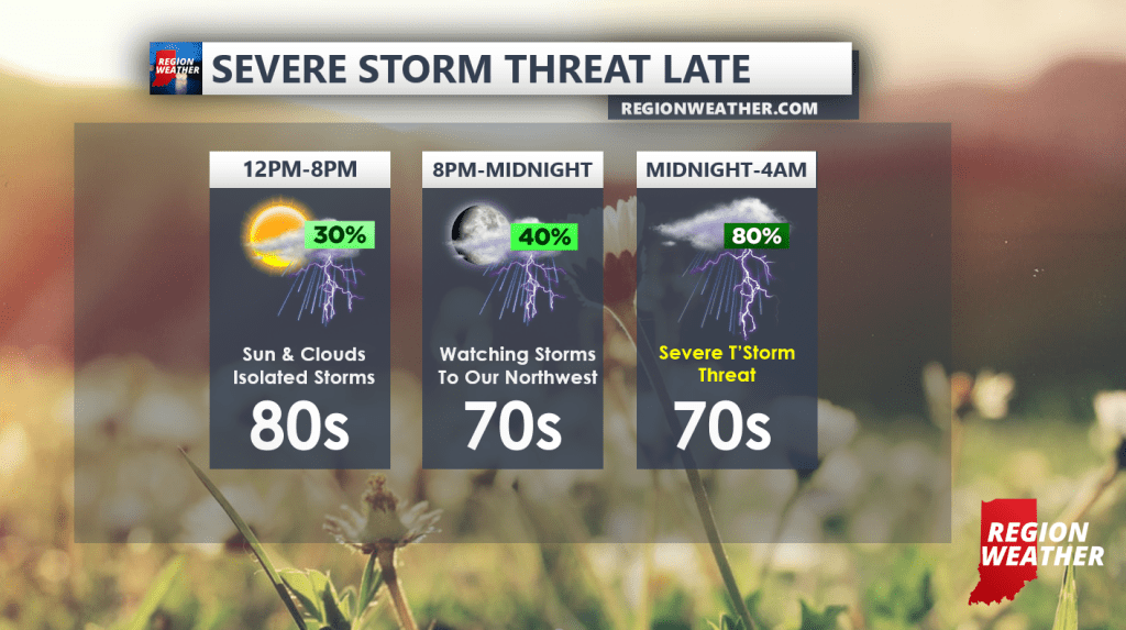
In terms of timing, this will be a late night storm threat. We likely won’t see much at all through the afternoon and evening. We’ll begin to track it southeast this evening but it doesn’t look to arrive until after midnight.
Here’s our timing forecast:
We’ll have updates throughout the afternoon and evening here and on our Facebook Page, stay tuned!
