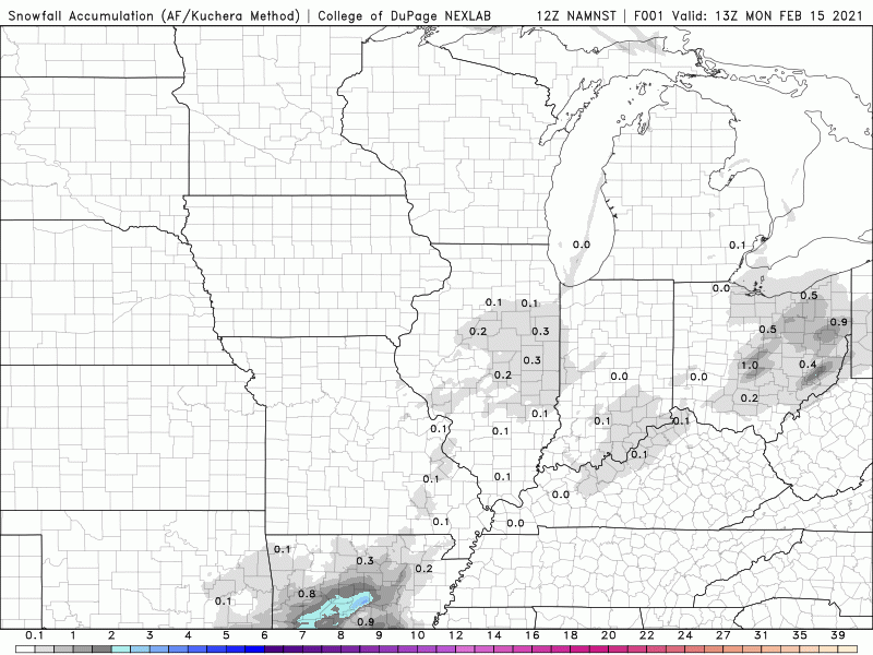
A major winter storm will continue to track northeast into the Ohio Valley through the day Monday bringing a widespread area of moderate to heavy snow through the Hoosier state before exiting later tonight. This storm has brought historic snow to portions of Texas, Louisiana, and the southern Plains.
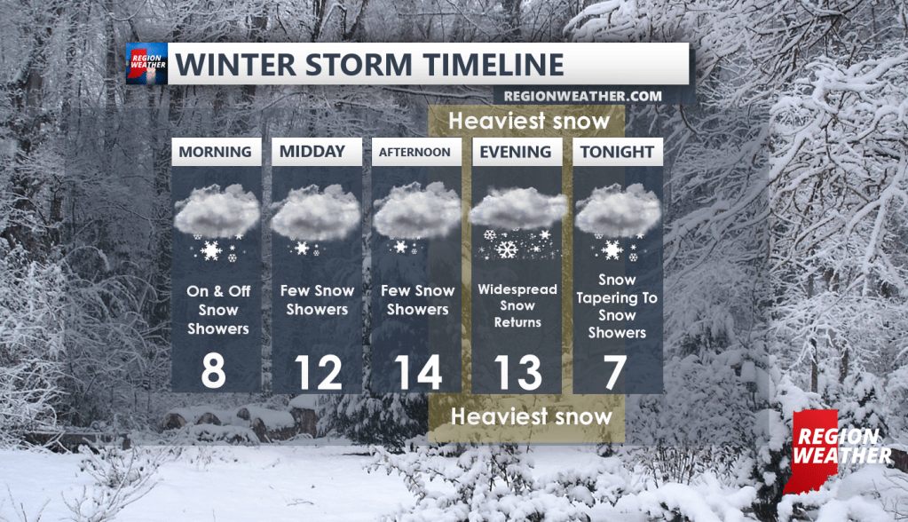
TIMELINE
We’re still expecting a break during the day today with scattered snow showers at best. The main storm system will then quickly move in from the south later this afternoon into the evening commute. Moderate to heavy snow is expected this evening with rapidly deteriorating conditions area-wide–especially the further south and east you’re located closest to the low pressure. We expect snow to taper pretty quickly tonight as the low departs after a 5-7 hour window of some heavier snow.
LAKE EFECT SNOW
The band of heavy lake effect snow has shifted west through the Region overnight bringing up to 10 inches of snow to Chesterton and areas of Porter county last night. The lake effect will hang out in Cook County today (we’ll have to see if it fluctuates back into western Lake County briefly). We’re expecting the lake effect snow to move back into the Region Tuesday as the winds turn more northerly and then northwesterly with several additional inches possible before it all comes to an end.
HOW MUCH SNOW?
Our forecast totals remain unchanged with a widespread 4-8 inches expected this evening into tonight for everyone. The highest totals will likely be the further south and east you’re located as the heart of this storm will work through the eastern and southeastern half of the state. Lake effect may add an additional few inches Tuesday before ending.