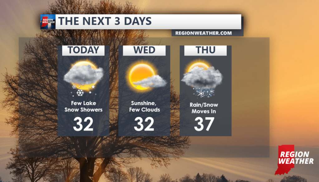
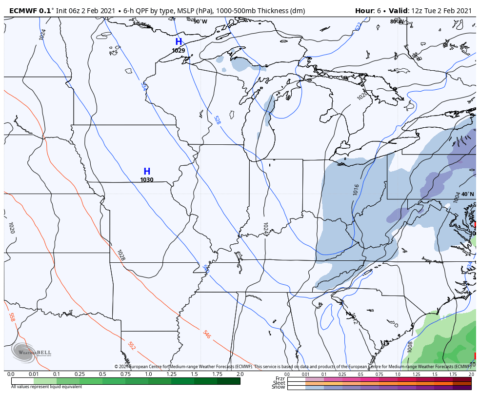
High pressure will gradually take control of our forecast over the next 24 hours bringing an end to the clouds and lake effect flurries and snow showers.
We’ll then turn our attention to our next storm system that will bring a round of rain/snow that changes to some snow Thursday into Friday with our first round of cold air behind that.
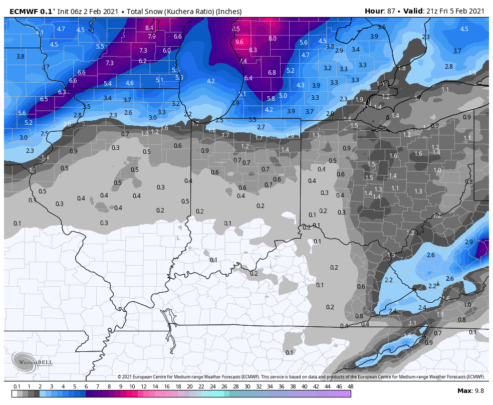
In terms of snowfall, the bulk of the snow with our mid-week storm will be to the north where 4-8 inches will fall in Wisconsin and portions of Michigan. We could see some light accumulations Thursday into Friday once our rain/snow mix changes over to snow before quickly ending. (maybe an inch or two as of now, favoring our lakeshore counties)
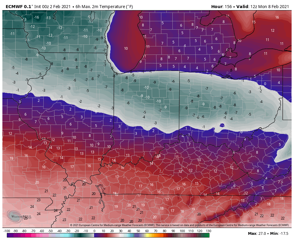
Temps will tumble this weekend before another arctic front moves through bringing us the coldest air of the season by the end of the weekend.
Monday morning temps are still looking pretty brutal:
Here’s our forecast for the next 3 days: