
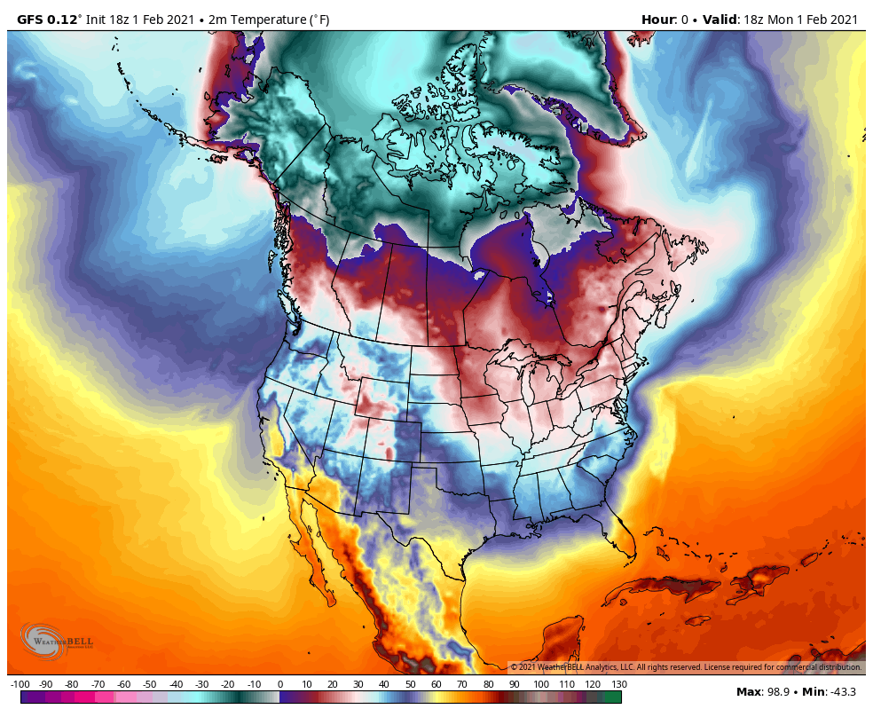
We’ve been flirting with the arctic air all winter, but it’s stayed up in Canada (where it belongs if you ask us). Well, that’s about to change this weekend into early next week.
This will likely come in two stages. The first dose of colder air would arrive Friday. The second, more potent round of frigid air would arrive sometime Saturday into Sunday.
Air directly from the North Pole will dislodge into western Canada over the next few days and our mid-week storm system will move through the Region and head northeast into eastern Canada. As that storm goes up–that cold air in western Canada gets pulled down with a widespread cold-spell expected for the eastern US.
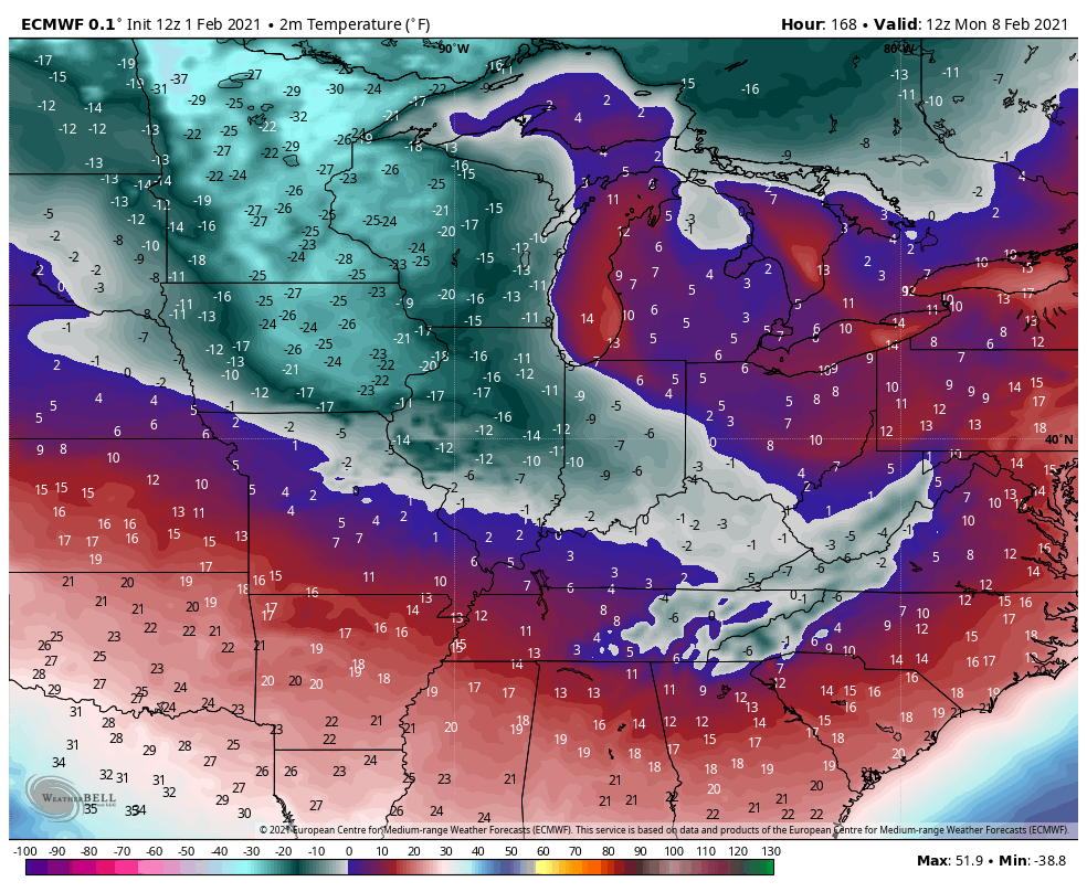
Just like snow totals this far out, it’s not wise to put numbers on it at this point. Just know it’s likely going to get colder. Like quite a bit colder. But, for the interest of entertainment, let’s take a peek at some of the numbers the models have this early in the game.
EURO MONDAY MORNING TEMPS:
Yikes!
GFS MONDAY MORNING TEMPS:
Yikes again! Like really yikes!
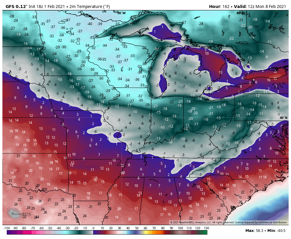
Either way, this will rival some of our coldest readings in year and will certainly be the coldest airmass of this relatively mild winter so far. February is just getting started it seems.
We’ll keep you updated. Until then, find the stack of blankets in the linen closet.
