
***Please check for updated posts on our webpage with the latest data and forecasts***
FRIDAY UPDATE
As we’ve discussed since earlier in the week on our Region Weather Facebook Page , a large and potentially impactful winter storm is on the way to the Region Monday into Tuesday. This storm will likely bring accumulating snow as well as some icing potential to NW Indiana.
KEY POINTS
- Potential for our first decent snow of the winter season
- Storm moves in Monday (we’ll see some snowflakes Sunday–not related to this main storm)
- Snow to the north, snow and wintry mix to the south possible as of now
THE LATEST FORECAST
An area of low pressure will track through the southwestern US and emerge in the southern Plains Sunday. This low will gather a lot of Gulf of Mexico moisture (big difference over our moisture-starved systems from Canada in recent weeks) and head northeast towards the Ohio Valley.
We’ll already have plenty of cold air in place (you can feel it now). Once we throw moisture into this cold air, we’ll see quite the wintry mess on the northern side of this system as you’d expect for January.
Just where this mess ends up is the big question, but we’re seeing decent consistency with the models over the past 3 days and confidence is growing in exactly how this storm will play out. This storm is still over 3000 miles away! It’s amazing that we can even begin to tell what a system that far away will do in terms of our local weather.
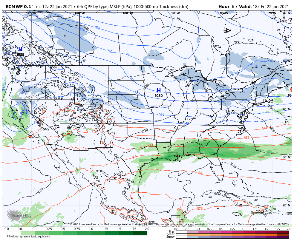
Here’s the latest Euro (as of Friday afternoon–please check for updates on our page as data will change) The Euro hasn’t changed much in the last 2 days and brings snow (heavy at times) into our northern counties (Lake, Porter, LaPorte) and snow that changes to a wintry mix then back to snow in our southern tier of counties (Newton, Jasper, Starke):

The latest GFS has shifted north (as we hinted it might do yesterday on our Facebook LIVE!) but keeps the wintry mix around longer leading to slightly lower snow totals:

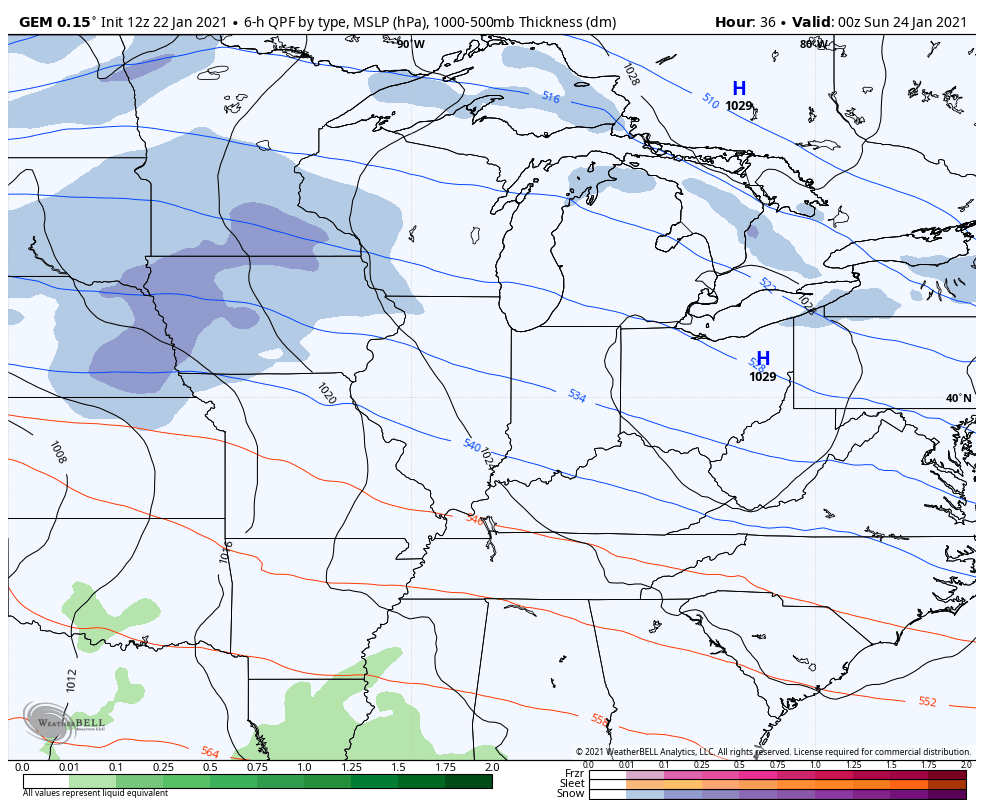
The Canadian model is similar to the other two but develops some lake effect snow on the back side of the system and is just a touch south of the other two models:
SNOWFALL POTENTIAL
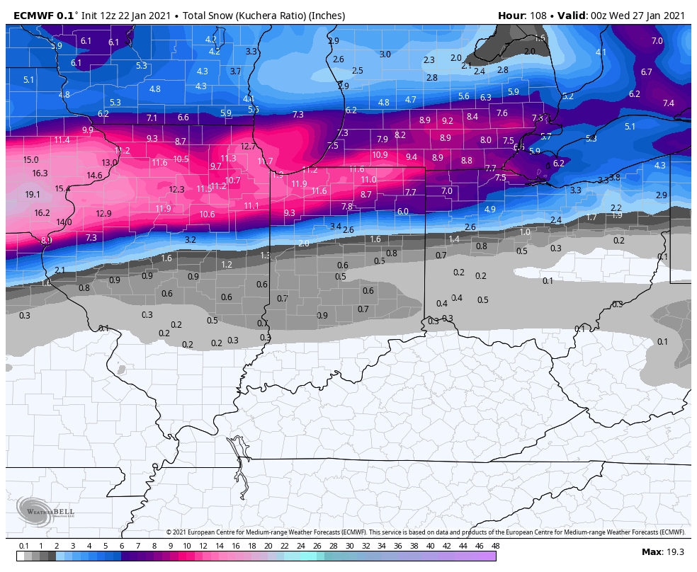
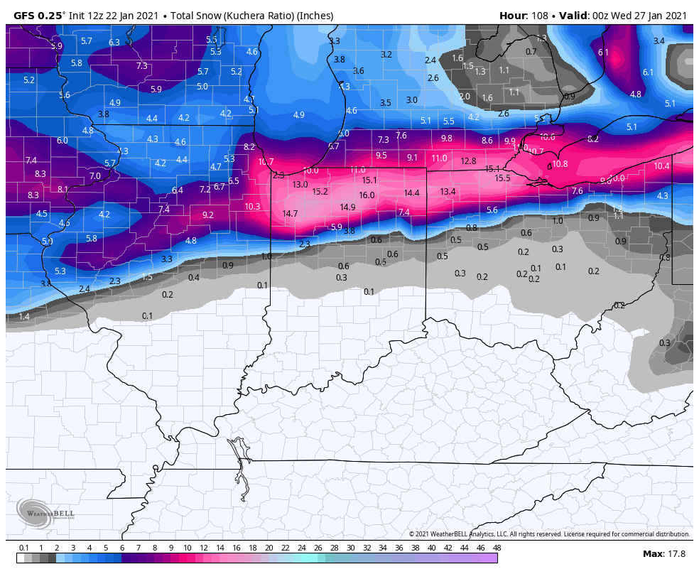
Here’s how the models stack up in terms of snowfall potential. Speaking of stacking up! Keep in mind, don’t pay attention to exact numbers–we look for trends this far out and the trend is for some decent snow with this one wherever that northern periphery of the storm goes…
The Euro:
The GFS:
The GEM:

As of this Friday afternoon, the models AVERAGE 8-14 inches of snow across a good portion of the Region. Again this will change, but we have the potential for a good snow.
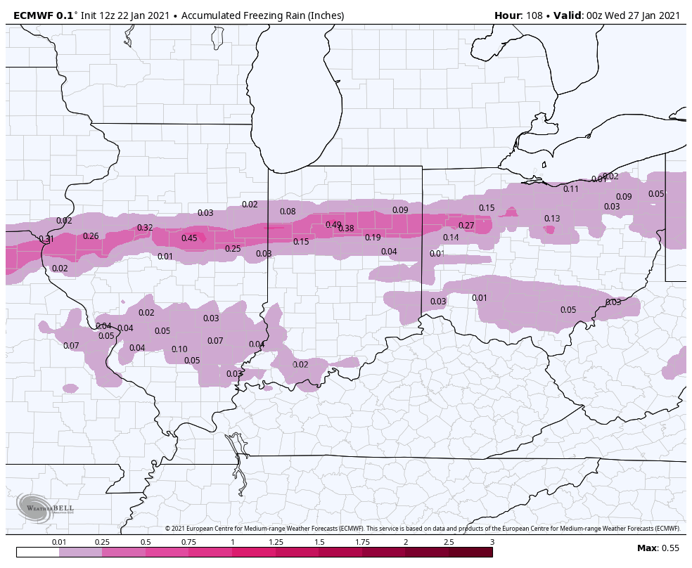
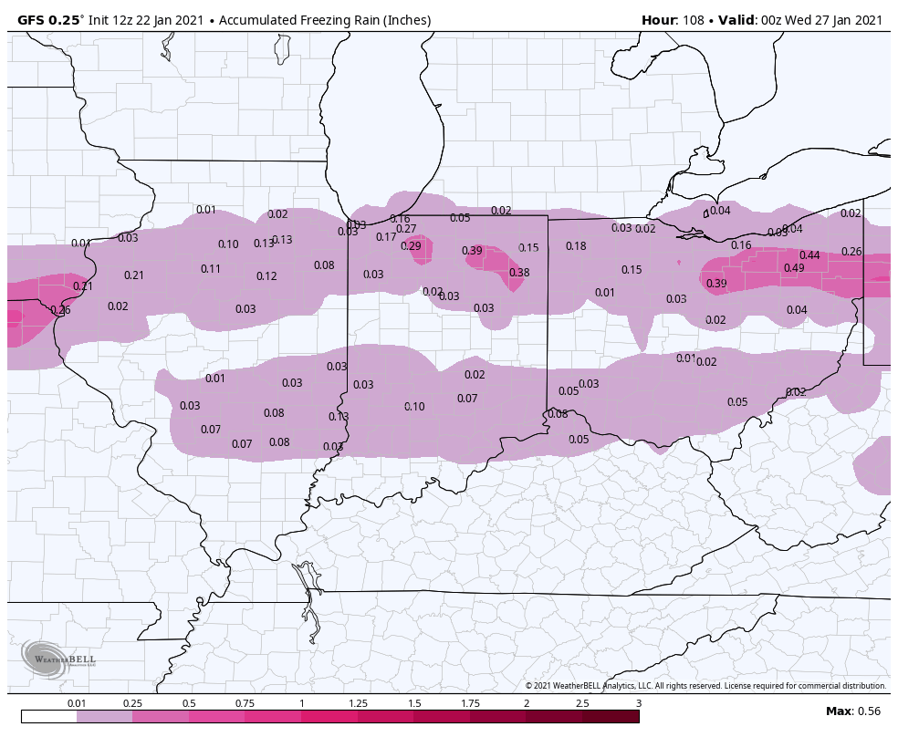
ICE POTENTIAL
In terms of ice, here’s the Euro:
The GFS:
The GEM:

Stay tuned! Make sure you FOLLOW our Facebook Page for updates including our Region Weather LIVE broadcasts. We’ll pass along updates throughout the upcoming weekend.
