
An important forecast looms for next week as we continue to see signs of a rather potent storm system that will develop and head through the Region Tuesday into Wednesday. Model madness continues as we all seem honed in on the latest model run and as of this afternoon’s all important 12z run–we have some consensus!
What’s this mean? The GFS, the Euro, AND even the Canadian model have all come into much better agreement what they think will happen with this storm. It doesn’t always stay this way, but this increases our confidence in how this storm will play out locally. Here’s the summary of what has changed:
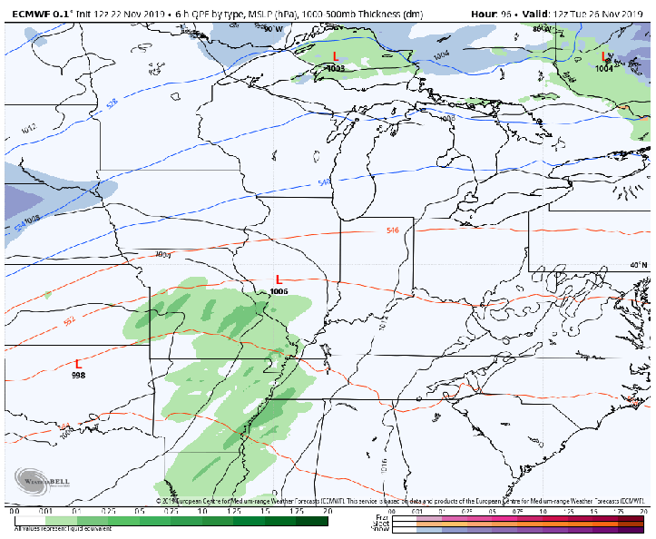
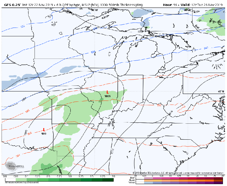
- Models now ALL bring the low through Illinois into Michigan–west of us. This keeps us on the WARM side of the storm which means mainly rain. The heavier snow and accumulation would track to our northwest–but those with travel plans in northern Illinois and Wisconsin will have some problems with the latest idea. Keep in mind, the path of snow is still very close and we’ll keep a close eye as it fluctuates over the next few days.
- Models have a slightly weaker storm. Experience tells us this will change over the next few days as well. We still have a windy storm, but the snow totals where it does snow are not overblown like they were the last few runs.
Let’s take a look at the maps. Take note of how similar they are…finally!
Latest Euro TUE-WED:
Latest GFS TUE-WED:
Latest Canadian Model TUE-WED:

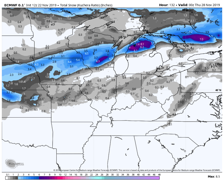
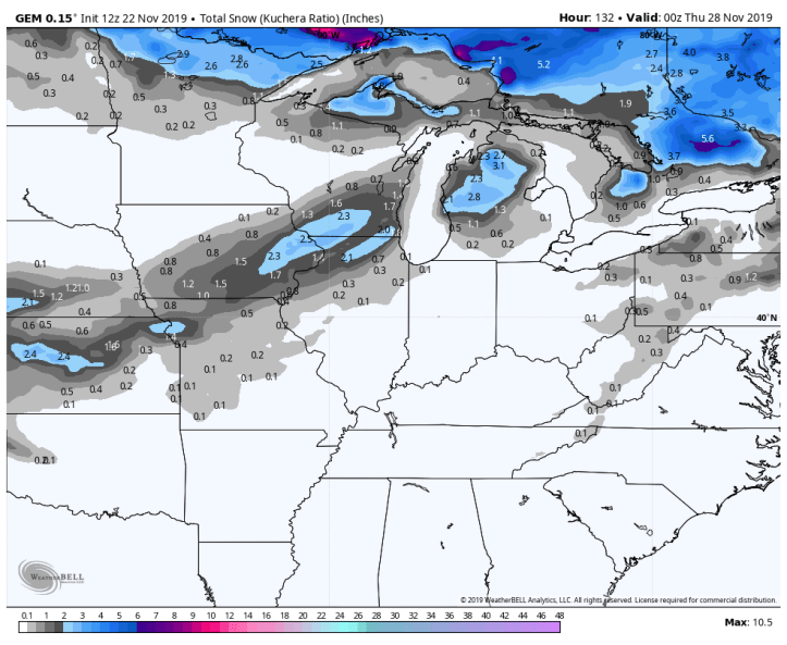
In regards to snowfall, the result of the northward push of the snow track brings 3-8 inch totals across Wisconsin and Michigan. With all rain, we won’t see much of anything in this scenario.
The Euro:
The GFS:

The Canadian:
The latest run is a bummer for snow lovers, but I’m pretty sure all those with travel plans locally are rejoicing!
Our next steps are to make sure the models maintain their agreement and then we watch the TRACK of the low pressure wobble back and forth until it agrees…but we’re much more confident in this storm than over the last few days that we’ll have a wind and a rain-maker on our hands. Stay tuned!
