
If you’ve known me long enough, you’ll remember I’m anti-longterm forecast for a variety of reasons…but that’s when it comes to specifics. People will ask, “will it rain at my house 3 weeks from now?” to which there is no accuracy to such a forecast. But when it comes to trends, whether it be warmer, cooler, rainier, drier, etc…we’ve come a long way in the world of meteorology! Through years of learning what to look at and what not to look at–I can give you a pretty good idea of what we can expect beyond the 7 day…so let’s take a look!
One of the first things I’ll look at is the upper part of our atmosphere in and around the jetstream level–which directs the flow of our airmasses (hot or cold) and storm systems (rain or no rain).
Right now we have a decent flow from the northwest–which shuts off the Gulf of Mexico moisture and brings us cooler, drier Canadian air:

As we head into the weekend, an area of low pressure still looks to head through the Great Lakes bringing a reinforcing shot of cooler, drier air on the backside of the system. The result is a jetstream that looks like this:

Still out of the northwest. No thick humidity. No 90 degree temps.
As we head into next week, a larger scale system will develop up in Canada and will help to keep our cooler, drier weather going with a consistent flow still out of the northwest! Wow!

Sure the meteorologist is cool and geeky, but what’s that mean in terms of user-friendly numbers like temperatures?
As of today, the dome of heat we talk about a lot has shifted west and south into Texas. This is where it typically resides in July heading into August:

By the weekend we get a day here and there with mid 80s perhaps, but that flow out of the northwest will quickly shut down any potential heatwaves in the Region:

And by next week that larger scale system in Canada will REALLY shrink the heat dome in the US and oughtta bring us some comfortable temps–especially for late July!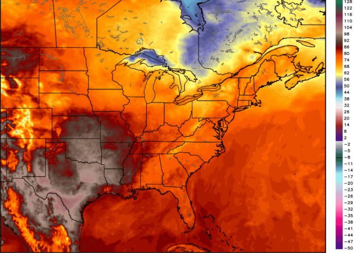
Finally let’s look at the numbers the models are spitting out as of today–these will change but again, we look for trends. The first graph shows the possible RANGE of temps each day–we should stay focused on the main line which keeps temps in the 70s and 80s, but interesting to note is the fact that even our MAX temps possible barely eclipse 90 over the next 15 days. Our forecast? We don’t hit 90 degrees for the next 15 days…

And finally, an easier to read version of the above chart–don’t pay attention to the exact numbers–just the fact that there are numerous 70s and 80s during a time of the year when we could easily see heatwaves:

We’ll be here to enjoy the ride with you! Stay tuned!
