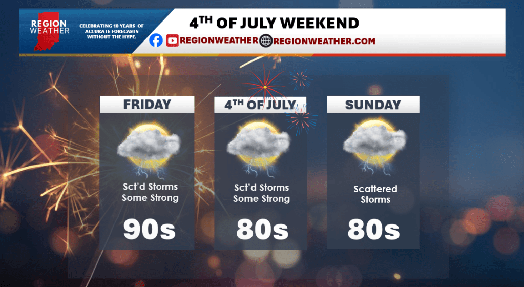
4TH OF JULY WEEKEND FORECAST
Firework plans will need to have a watchful eye on the radar as we introduce storms back to our forecast for the entire 4th of July weekend. No day looks to be a washout, but this pattern we have coming up will feature those larger complexes of storms that roll through the Great Lakes at times with dry hours in between. Too soon to tell when and where we’ll get hit, but just know storms will be around all weekend. With this heat and humidity, some of the storms will likely be severe with a threat for heavy rain and damaging winds as the primary risk.
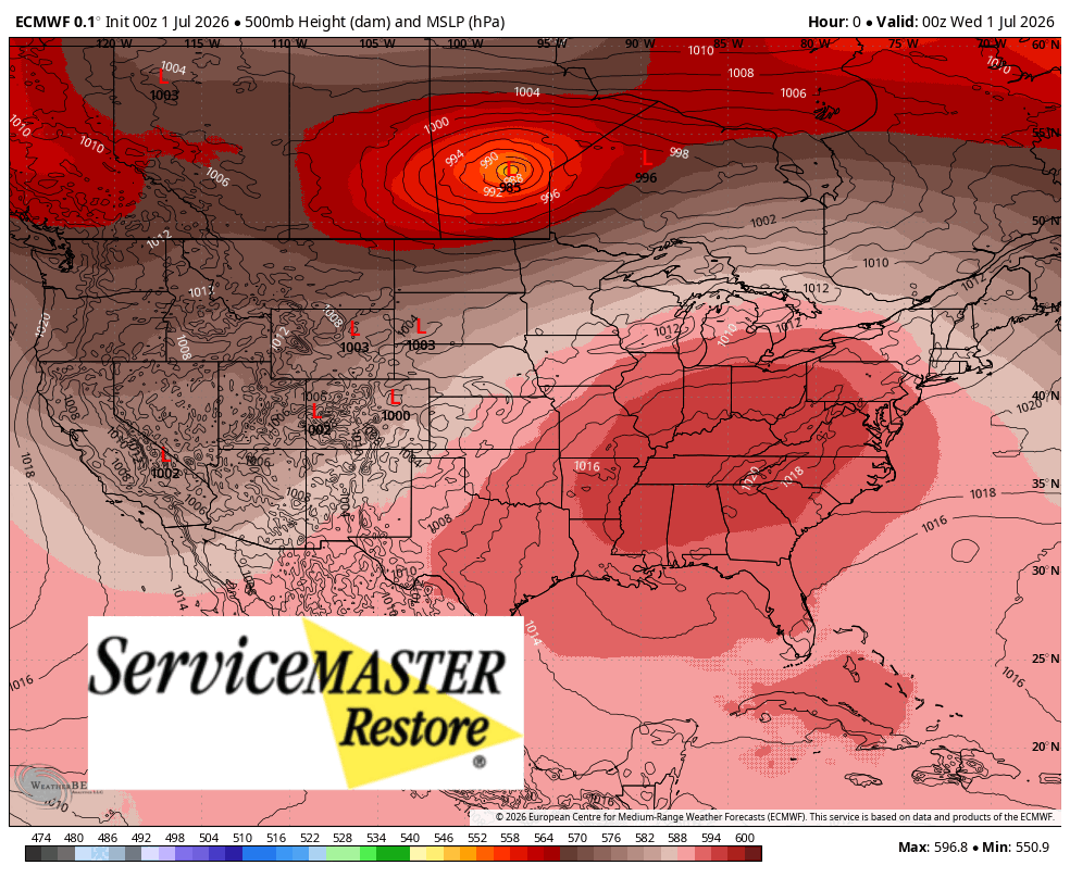
HEAT RIDGE BREAKS DOWN
This dome of heat that is centered over the Ohio Valley will begin to break down this weekend and eventually retreat to the west. There are signs that it builds back in mid-July, but we’ll deal with that when the time comes. The breakdown of this ridge is good because the real hot temps go away, but it brings showers and storms back into our forecast.
Unfortunately, this “path” of storms will reside right over the Region starting late Thursday through Sunday with multiple rounds of storms–some of which could be severe–through the area. We’ll be keeping a close eye on the timing and impacts from any severe weather ahead and will pass along the latest.