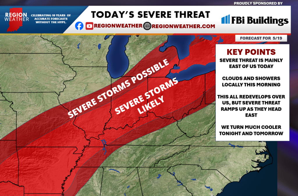
TODAY’S SEVERE THREAT
Good Tuesday morning everyone! Our cold front is on the move and we’ll once again inherit the leftover of overnight storms this morning. The good news is, there’s not much left with the line of storms that developed to our west overnight. Just a few showers and clouds will move through this morning into the midday hours before everything refires this afternoon. The highest threat for severe weather is east of us later today, but we’ll need to keep an eye on anything that initially develops over the Region. We’ll turn much cooler tonight and tomorrow!
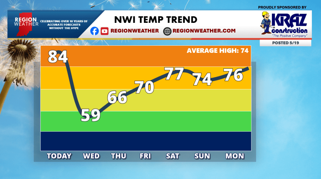
Behind this system we turn much cooler and less humid. Take a look at the Region MuggyMeter the rest of the week as that humidity takes a dive.
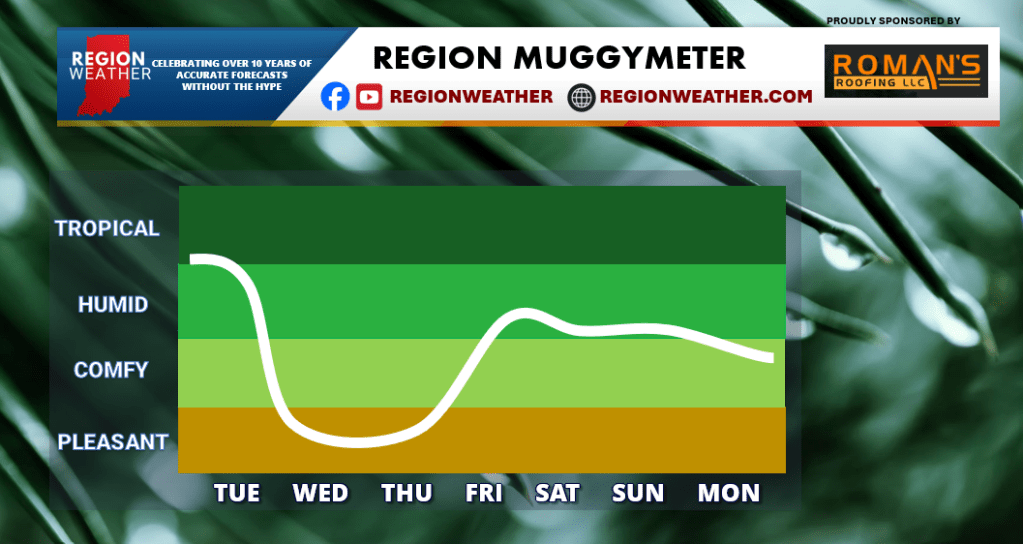
Humidity and warmth will return this weekend but it also comes with rain. We’re still looking at a rather rainy weekend around here–especially later Friday into Saturday at this point. Temps will finally level out near average next week: