
MONDAY EVENING STORM UPDATE
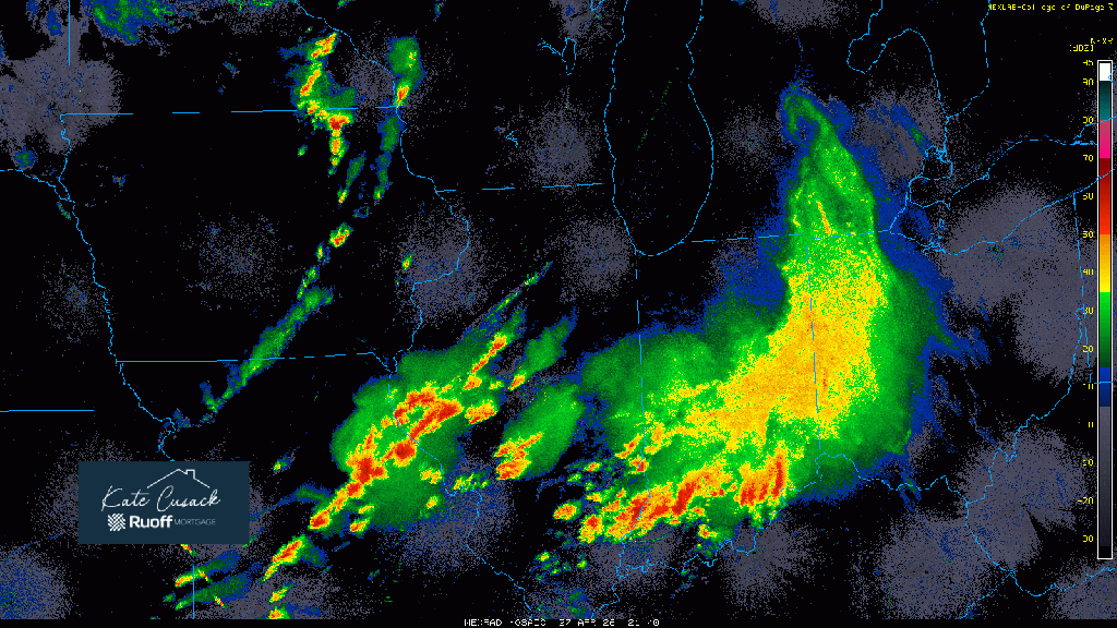
Still near 48,000 households without power here in NWI due to the strong, non-thunderstorm winds caused by a rather rare “wake low”. If you’ve never heard of those before, they can sometimes form on the backside of a large complex of storms this time of year and into the summer months. It’s basically a small-scale low pressure that develops directly behind a complex of storms that can cause 60+ mph winds as air rushes to fill that low pressure. Similar to a cork bottle when you open it. In terms of this evening, here’s the scoop.
Round #2 is upon us moving in with heavy rain, gusty winds, and lots of lightning. We are JUST missing severe storms to our south where you see that line has developed. Southern Newton and Jasper counties will get the strongest of these storms–but overall our severe threat is LOW from all of these. It’s what we talked about yesterday–lack of instability due to all of the ongoing storms and rain today, especially to our south. We’ll take the rain without the severe.

So thankful that the severe threat was low! Appreciate your updates Matt!
God bless you and your precious family and give you a good day!
LikeLike