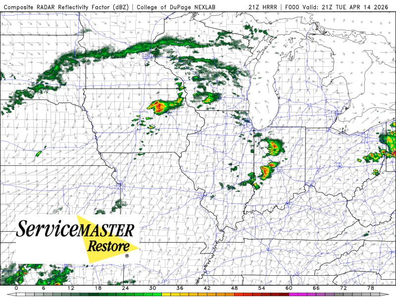
Big storms are rolling through Iowa and Wisconsin right now producing all modes of severe weather–a dangerous night for them. Locally, we’re in our anticipated break (from our previous post this afternoon) and will remain there as we watch a ton of activity to our north and west.
These storms to our north will gradually build our way with individual storms moving northeast, but the entire line will eventually sink to the southeast. All the wild severe stuff will stay north of us for the evening. What we will inherit is a weakening line of storms. It could still produce severe weather when it moves in, but the timing is on our side as the energy begins to wane within this entire structure. Damaging wind and very heavy rain in addition to lightning are the main threats with storm arrival not expected until overnight. Timing places this line in here after 11pm into the early morning hours.
Again, I’m not overly hyped on our local severe potential–it won’t be what’s going on to the north and west. We’ll have to keep a close eye on it for the above listed threats, but the scary stuff you’re seeing on social tonight will not be our story locally, so get some sleep.
See below for the latest hi-res run of how this all looks to evolve: