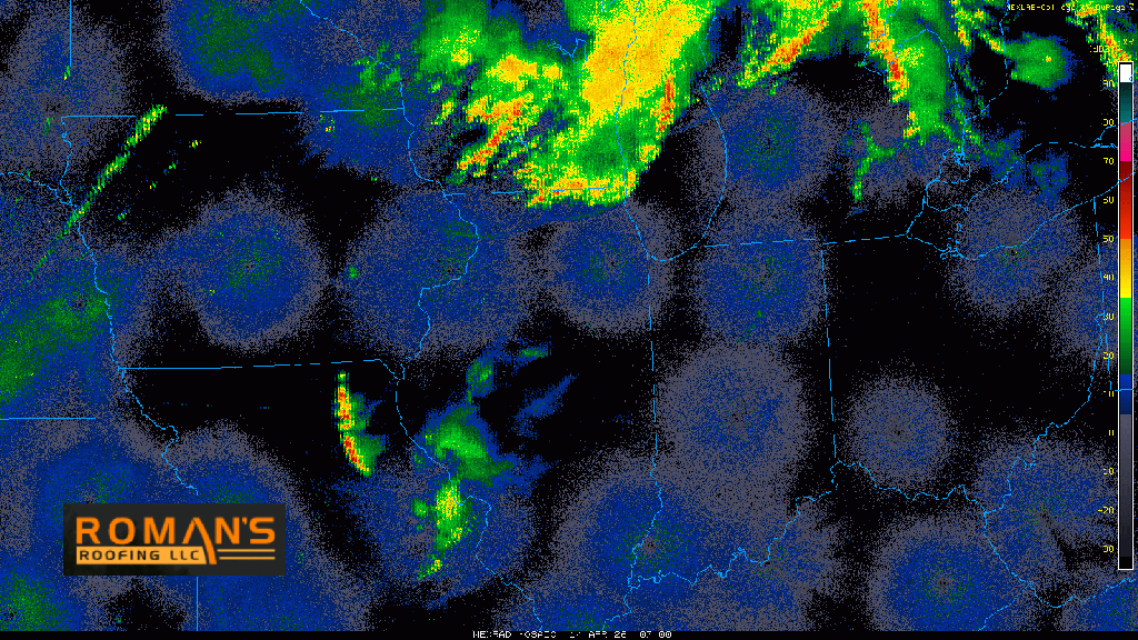
MORNING RAIN & STORMS
Good Tuesday morning everyone! We’re inheriting the leftovers of that Wisconsin action last night and it’s redeveloping a bit in our warm, rather humid atmosphere. Expect showers and storms to move through over the next few hours bringing heavy rain, lightning, and a few pockets of strong wind. This activity would then clear out and we’d await another round of storms to potentially develop later today into tonight.
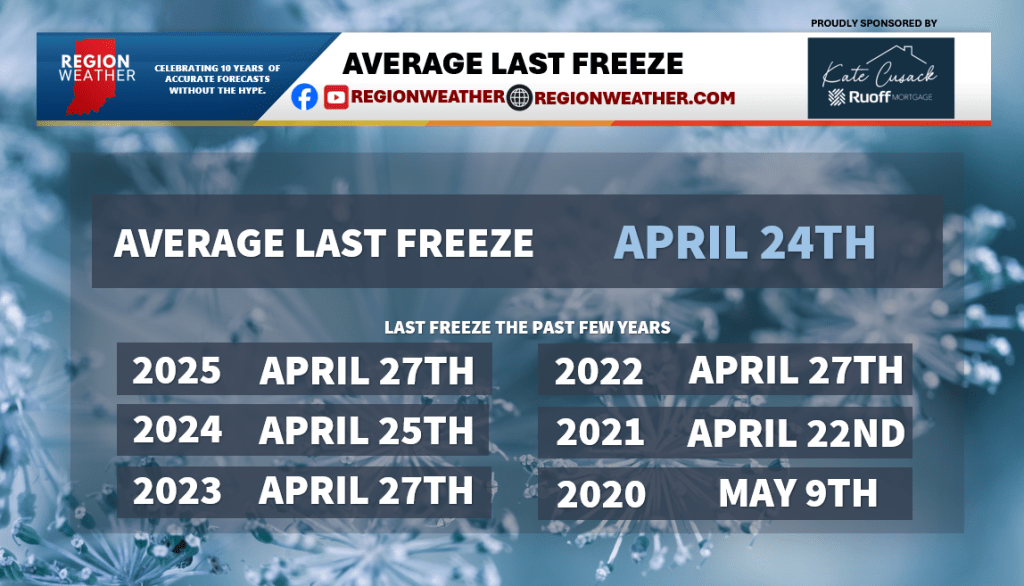
LAST FREEZE STATS: WE’RE TYPICALLY NOT DONE YET
This warm, humid air distracts us from the reality of NW Indiana weather. Since records began in northwest Indiana back in the late 1990s, we’ve ALWAYS had at least one more freeze between now and mid-May. Cold weather crops are good to go (like lettuces, radish, etc)…but those annuals are not. Our average last freeze is on April 24th, and this year it does look like we have a frost/freeze risk this coming Sunday night and Monday night. More cool air is possible to end the month and start May.