
Good Sunday morning to you everyone! We’re not usually looking at a severe thunderstorm threat when we start our day in the upper 30s with clouds and even snow showers to our north, but here we are in the early Spring of 2023 and that’s the case.
A sneaky, but potent little shortwave of energy will zip right through northwest Indiana today bringing the potential for a developing line of brief rain and storms–some of which could be strong to severe. Temps will be split across the Region today with mid and perhaps upper 50s in our southern counties with upper 40s to low 50s in our northern counties. This could fluctuate a few miles based on exactly where the front lays out–but it’s the sweeping cold front that will cause the problems as it quickly moves through this afternoon.
This is how it may evolve on radar:
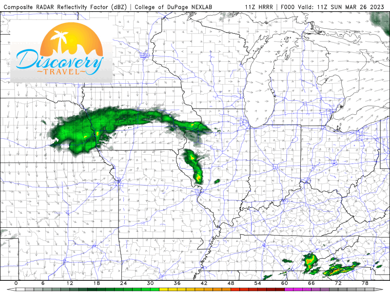
Our primary threats will be damaging winds with this line, but there’s enough shear present to spin up a few tornadoes if these storms indeed get going. Timing on this line would be anytime after 1pm–more than likely in the 2-6pm CT range. As always, we’ll be keeping a close eye on everything for you and will pass along the latest including special LIVE broadcasts if needed on our Facebook page.
