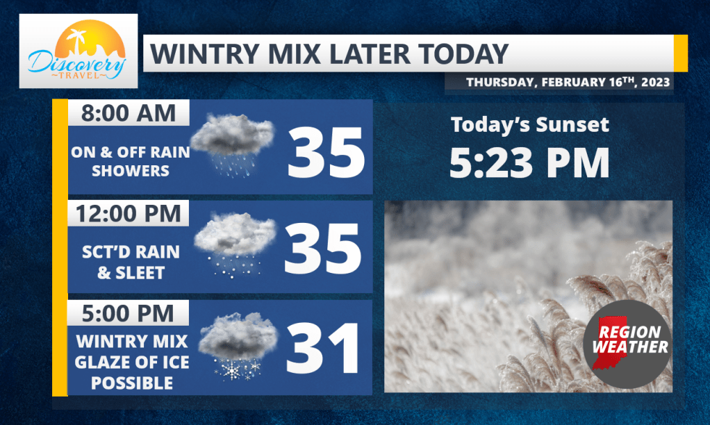
Good Thursday morning everyone! We’re not expecting anything major today, but that evening commute is the timeframe of concern for any untreated surfaces as an on and off wintry mix is expected later today.
Model guidance is coming in a degree warmer this morning, which may not seem like a big deal but when it comes to precip types–it is! As a result, we’re likely to stay rain (with some sleet mixed in) for longer today…this is good news! Expect scattered rain to eventually mix with some sleet in Lake, Porter, and LaPorte counties before a wintry mix of sleet, freezing rain, and some snow takes over this afternoon into that evening rush hour for all of NWI. We’ll turn all snow late this evening into tonight as a brief window of lake effect snow moves through.
Expect a glaze of ice by tonight with a coating to an inch or two of snow by tomorrow morning with the lingering lake effect. Overall this is a very manageable storm system, but those untreated surfaces will be slick