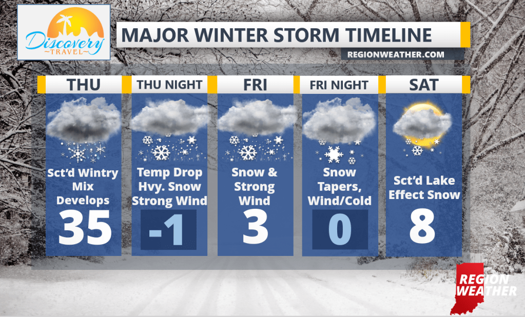
Enjoy the quiet weather both today and tomorrow out ahead of our powerful storm system that we’re expecting to develop late Thursday. It all begins Thursday with a scattered mix of rain, snow, and some sleet. Conditions will really go downhill Thursday evening as temps plummet from the low to mid 30s down to near 0 as the arctic air arrives. Winds will quickly ramp up with gusts in the 40-50 mph range possible. At the same time, heavy snow will move in and the snow will continue with strong winds much of the day Friday. We’re still expecting blizzard conditions at times Thursday night through the day Friday with bitterly cold temps. We’ll slowly recover with leftover lake snows, mainly east, on Saturday into early Christmas morning, but the wind won’t die down until Christmas. More updates to come throughout the day!