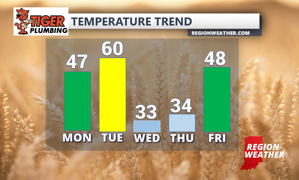
We’ll start our week out on a quiet note with a mix of clouds and some sunshine and high temps pushing into the mid to upper 40s. We’ll have one storm system to deal with this week and it’ll be a wind-maker for a good portion of the Great Lakes including us here in the Region. It all begins Tuesday with gusty winds developing out ahead of a cold front. These will be warming winds with temps expected to surge into the upper 50s to near 60. Rain will develop later in the day as the cold front approaches. A sharp temp drop is expected Tuesday night into early Wednesday morning with temps going from the upper 50s into the low 30s in the matter of a few hours. We’ll stay windy, but much colder on Wednesday with a few flurries and snow showers here and there. Winds will continue to be on the strong side through late Wednesday when the system finally departs, but leaves us with colder air for our Wednesday and Thursday as well.