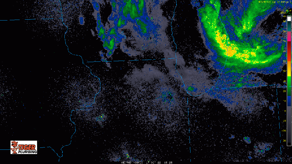
Good Monday afternoon everyone–just wanted to bring you an update regarding the set up for that lake effect rain and snow this afternoon. Model guidance has pushed the main band of rain/snow further to the east this evening and I would agree with that given the current radar trends with the main band of heavy rain pushing into southwestern Michigan. La Porte, Starke, and eastern Porter counties would stand the best chance at seeing some of the heavier rain & wet snow later this evening, but as always with lake effect, will continue to closely monitor trends and pass along updates! I still think we’ll have enough moisture and lift coming across that lake to get some rain/wet snow into Lake and Newton/Jasper county as well so you won’t be left out of this delightful weather (groan…)