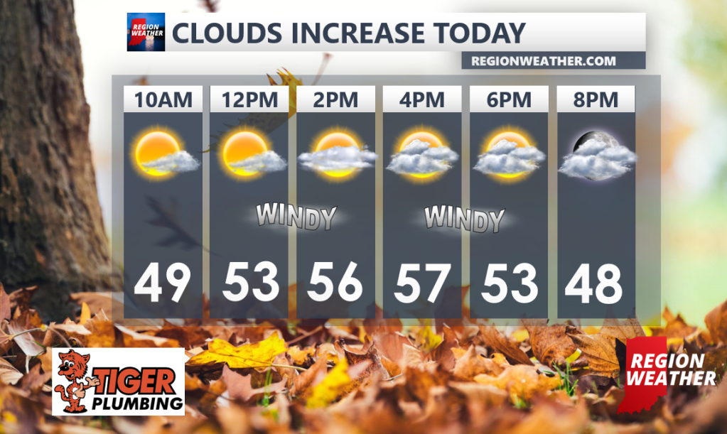
Today’s your day if you’re hitting the pumpkin patch or just soaking in the fall foliage around the Region! Clouds will increase today out ahead of our strong cold front, but we’ll squeak in one more day with highs into the 50s. The temp drop happens tonight when lows drop into the 30s and likely stay in the 30s to near 40 for highs on Monday! We’ll eventually kick off lake effect showers that will mix with some snow at times Monday and Tuesday. Let’s chat about those details tonight in our Sunday Evening Region Weather LIVE Broadcast.