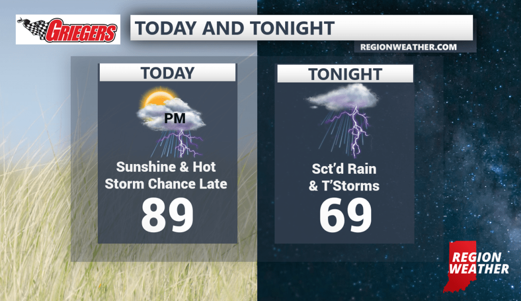
Most hours this weekend will be dry. However, we’re in that pattern where large complexes of storms will develop from the Midwest to the Great Lakes bringing a few rounds of storms–primarily targeting the late evening into nighttime hours. After a hot and humid day today, we’ll likely see storms erupt this afternoon and evening to our west. These should track into the Region tonight with the threat for heavy rain and frequent lightning. No guarantees in this type of pattern as models handle the setup poorly (we talk about that all the time in this setup). We’re looking at the potential for another round Saturday evening into Saturday night as of now. Stay tuned–we’ll have updates as the atmosphere evolves and does its thing!