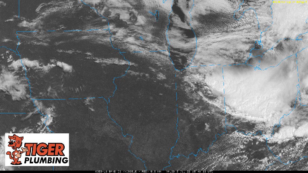
All is quiet on the satellite as of 2:30pm CT with a couple boundaries to note. The first is a stout lake breeze boundary pushing a line of cumulus clouds westward out of Chicago into the western burbs. Another boundary is draped from central Indiana back through Iowa. As we continue to heat, the lake breeze combined with that second boundary should ignite storms quite quickly over the next hour or two anywhere from the Chicago area back through Iowa. These storms shouldn’t take too long to move into northwest Indiana this afternoon into the evening. The threat for heavy rain, damaging winds, and hail will be present with our storms today–we’ll keep you updated.