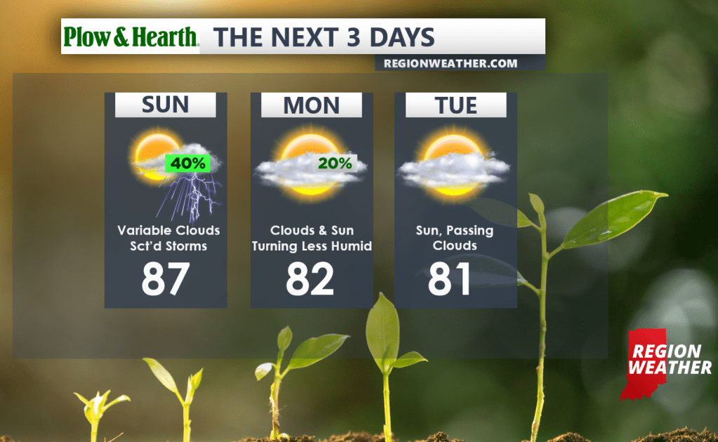
A frontal boundary will move through the Region today into tonight bringing the threat for showers and a few storms.
By Monday, less humid air will slowly begin to work in bringing an end to our tropical stretch of weather. We could see some lingering showers as the front exits, otherwise we’ll see clouds and some sunshine with highs in the low 80s.
Tuesday will feature passing high clouds with comfortable highs near 80. The remnants of Hurricane Ida will head south of the Region as this very cold front picks it up and shifts it east. We’ll likely see some high clouds off of Ida, but that’s about it!