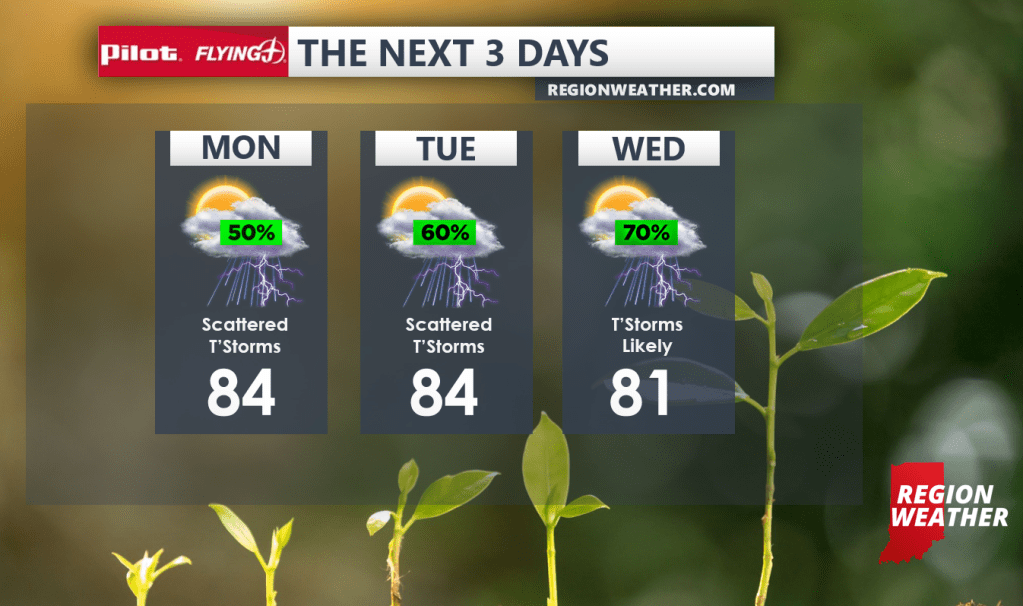
A Flood Watch remains in effect for the Region due to our localized saturated soil and the renewed threat for heavy rain-producing showers and storms. No real rhyme or reason for where and when they develop the next few days, but we do think we’ll see higher coverage as the frontal boundary approaches by the middle of the week. There’s light at the end of the tunnel–it looks like we’ll clear things out late week! We’ll chat more about this in our next update!