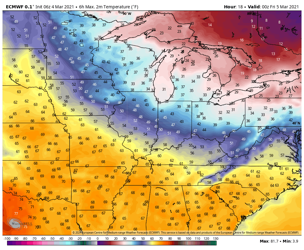
We’re in a holding pattern right now across the eastern United States as a large trough continues to dig into New England. This trough is responsible for a fresh batch of cold air, but more importantly, it’s stuck for now. The result is a weather pattern that remains unchanged across the eastern US with a cool northerly breeze and temps that are on the cool side as well.
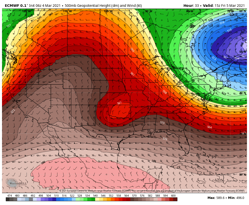
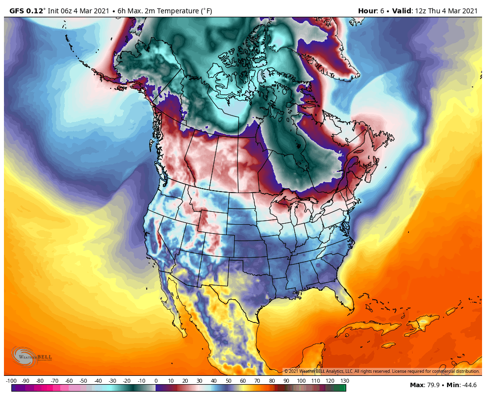
Notice the difference between the cold to the east, the in-between in the Region, and the building warmth to our west:
That boundary is still around Saturday into Sunday:

Then it changes.
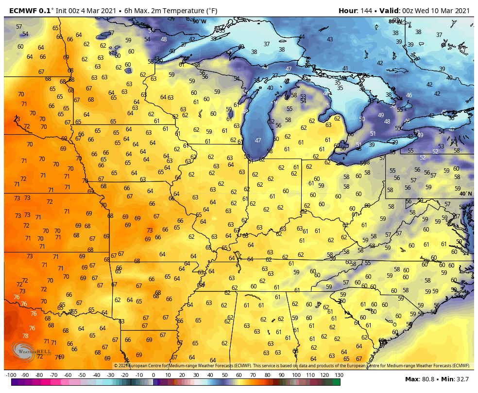
By the weekend it’ll begin to budge and will shift east as a large ridge builds into the center half of the country. This will allow spring-like warmth to return to the Region and to a large portion of the eastern US for the first time this year.

50s and 60s will be common for high temps next week, but the tradeoff will come with some rain chances.
Will the warmth last? More than likely no. We still have some winter left to go and that battle between warm and cold will continue through at least April, but in the short-term, next week looks great if you’re wanting warmer temps! Here’s the big picture showing the cold still dancing back and forth into the US from Canada the next 15 days:
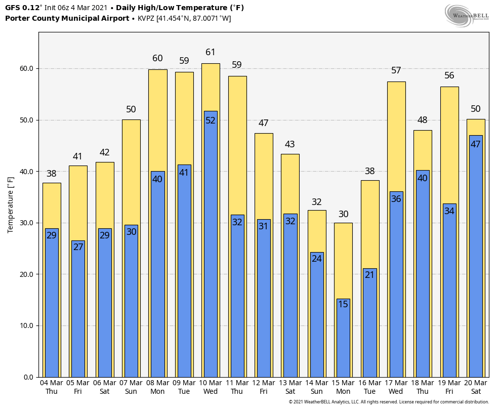
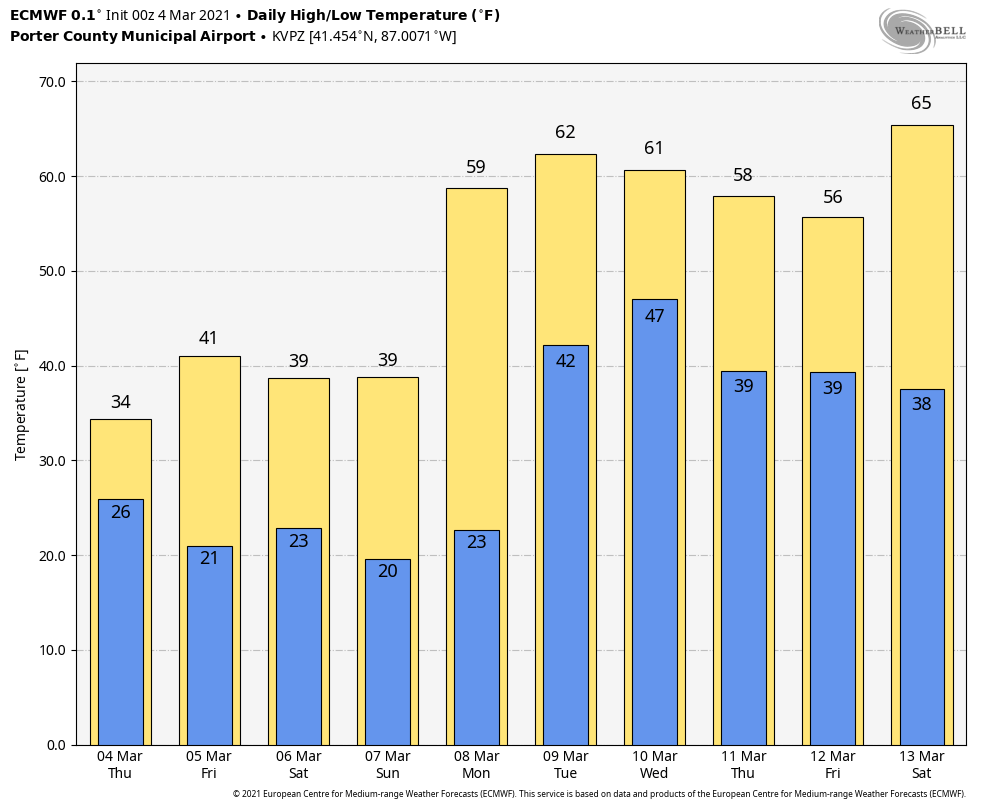
Here’s how the temps play out on the models–remember, this will change, but you get the idea of some warmer air next week!
The Euro:
The GFS has the warmth, but also shows the potential cold behind it: