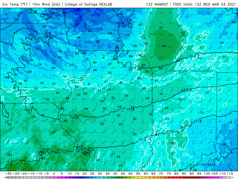
It’s that time of year when the wind direction means everything. We’ll begin today with a wind out of the west-southwest helping to propel our temps to spring-like levels in and around 50.
That wind direction means everything.
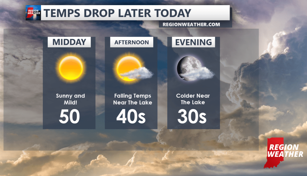
This afternoon our winds will shift out of the north bringing much colder air inland–most noticeably closest to the lake. Temps will go from near 50 down into the 30s by evening–a much colder afternoon and evening for Lake, Porter, and LaPorte counties!
We’ll likely see normal day to night cooler for Newton, Jasper, and Starke counties with our 50s falling back into the 40s and gradually into the 30s tonight.
The good news is that we’ll be seeing lots of sunshine and this frontal boundary will pass with little fanfare other than our falling temps and wind shift.
These “cooler near the lake” temps will continue for several days with lakeshore locations struggling to warm up while inland locations continue their mild rebound through the end of the week. EVERYONE will warm up into next week as our northerly winds back off and a warming south wind takes over area-wide.