
After a relatively quiet period of weather this week (despite the stubborn clouds), our weather pattern will become quite active again as the jetstream takes a dive into the central US bringing a series of storm systems through the heart of the US.
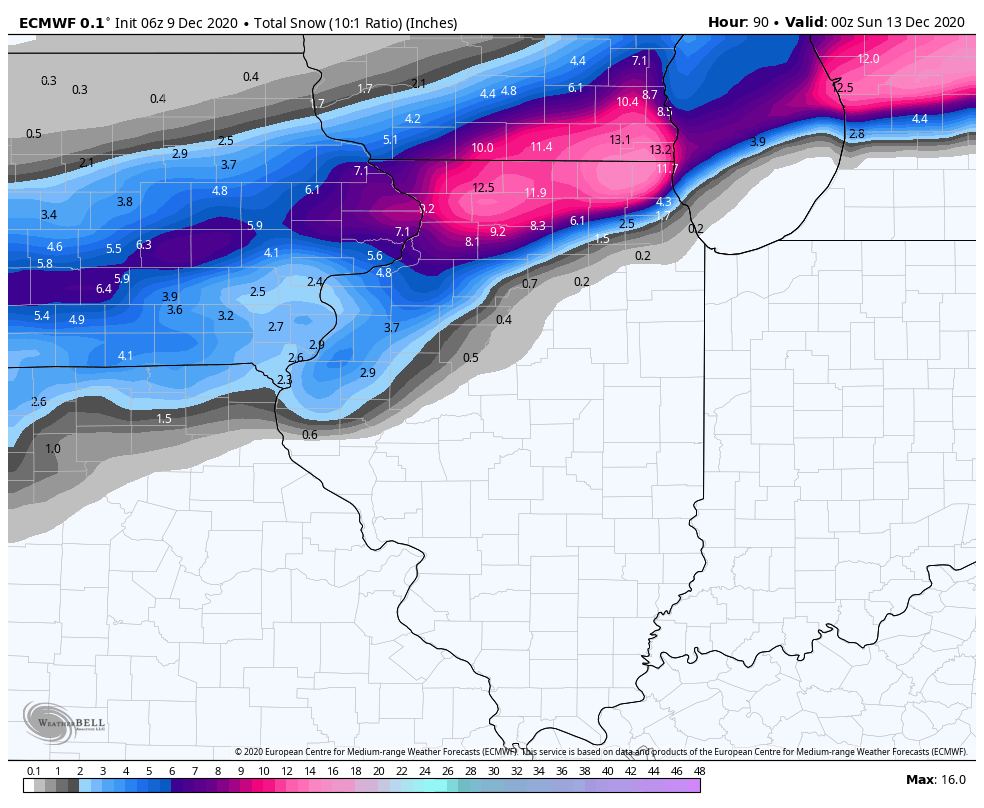
Our next storm will develop in the central Plains with a strengthening area of low pressure that will likely head right over the Region. This will keep the system as a rain-maker for all of Indiana, but we’d expect that rain to mix with some wet snow (and perhaps briefly changeover) at the end of the storm as colder air moves in. For snow-lovers, you never want the low pressure to head right over you. The heaviest snow usually falls to the north and west of the low and this will be the case with this storm. Take a look at the projected path:

This will be a snow-maker for Missouri, northern Illinois, Wisconsin, and Michigan where over a foot may fall in spots. For us, don’t expect much in the way of snow, but we’ll see some decent rain and wind with this one.
In terms of timing, here’s what we’re thinking:
Friday PM: Rain develops
Saturday AM: Periods of rain, breezy
Saturday PM: Rain mixes with wet snow
Sunday AM: Leftover snowflakes, otherwise clearing
We’ll keep you updated as always right here and on our Facebook Page.
