
The first winter storm of the season for the eastern half of the US will develop and move up the Tennessee and Ohio Valley eventually making it’s way into the eastern Great Lakes Monday and Tuesday. This system will bring wind, rain, and heavy snow to portions of the Ohio Valley. For us locally, we’ll likely miss out on the axis of heavy snow associated with this system, but the abundant moisture, arrival of colder air, and fetch of winds across Lake Michigan will kick off lake effect snow Monday into Tuesday.
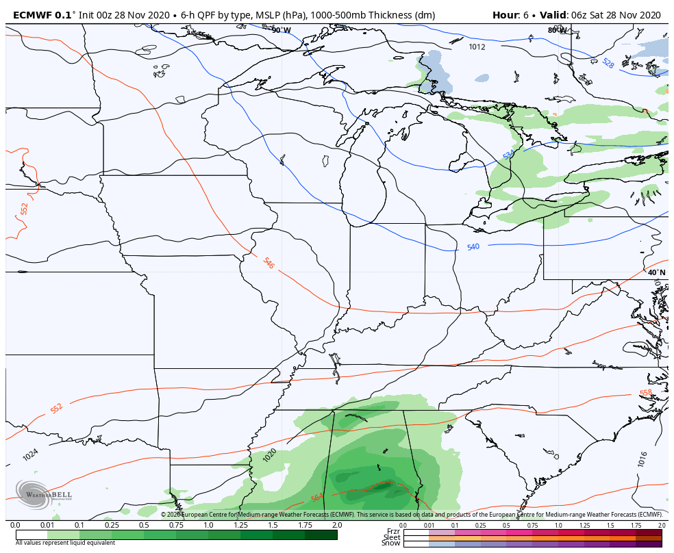
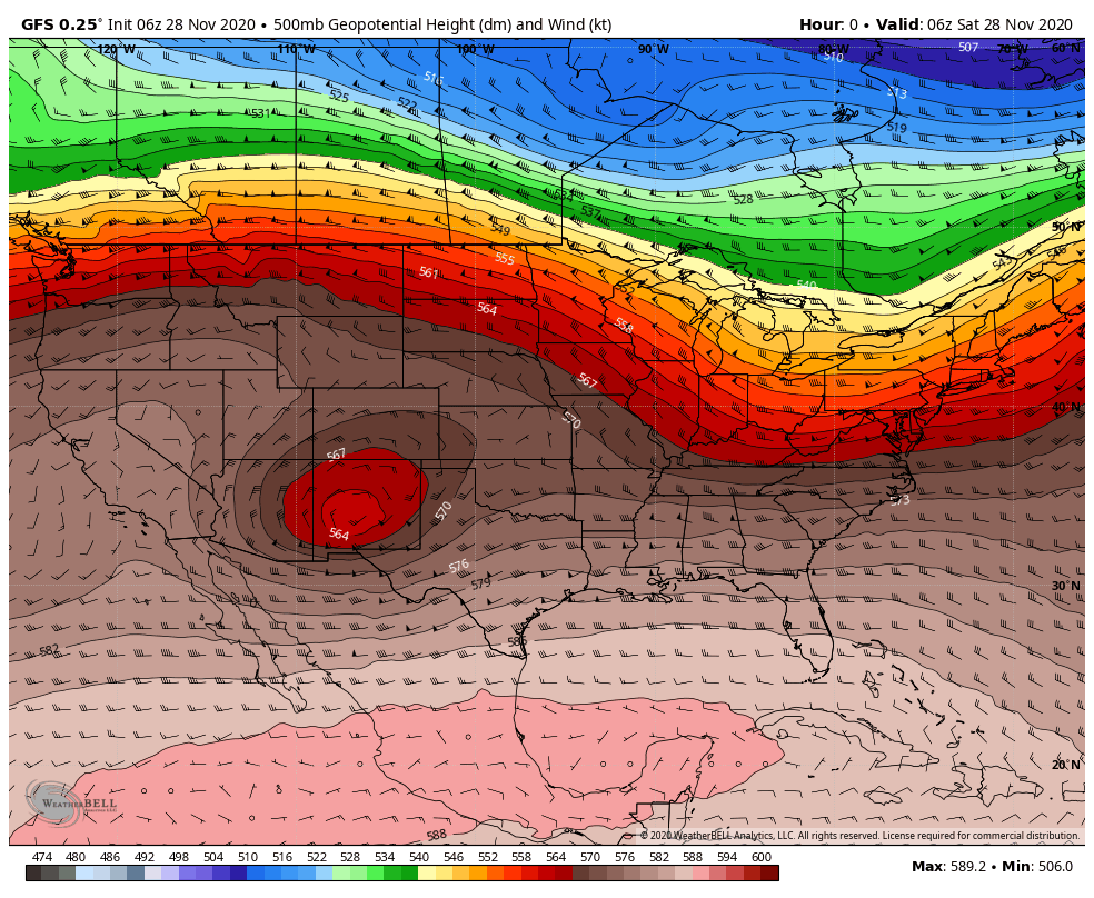
The entire thing develops from two areas of low pressure–one cut-off low now meandering in western Texas and another trough in Canada that will eject southeast over the weekend. One low will supply the moisture and the other will supply the cold air. This is still a complex storm system as the phasing of the two low pressure systems can provide lots of outcomes depending on the timing of the cold air and its arrival into the large area of moisture. All that to say, we could still see some minor changes in the track of the low and the intensity based on how these two lows come together.
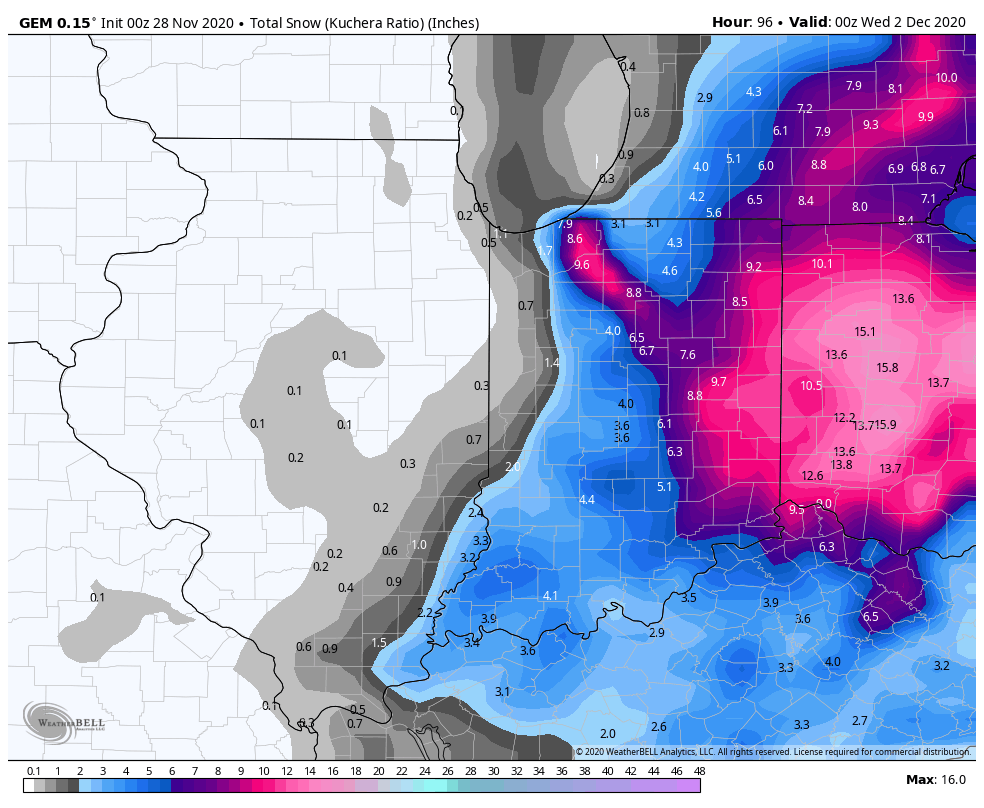
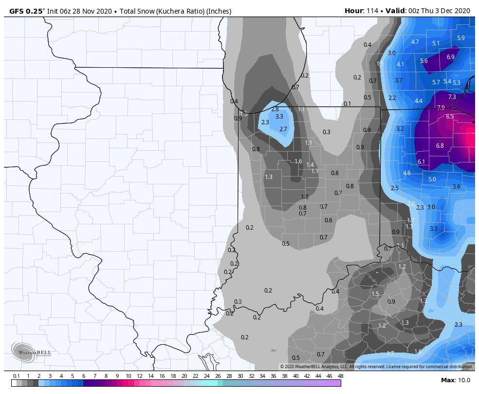
Here in NW Indiana, it still looks like lake effect snow will develop Monday as the moisture arrives and the cold air drives across the lake. A lake effect band (or multiple bands) of snow will likely better organize by Monday evening into Tuesday bringing accumulating snow to portions of the Region through Tuesday.

The model guidance as of Saturday morning has lake effect snow potential for the entire Region. With very cold air aloft, relatively “warm” lake waters, and abundant moisture, we could see some decent plumes of snow as this system moves by to our east. We’ll start with more of a northerly fetch across the lake on Monday which would drive snow into Lake and Porter counties. By Monday night into Tuesday any bands of lake effect should transition to the east affecting Porter, La Porte, and Starke counties. With a strong wind aloft (and at the surface), the lake effect snow will likely drive into Newton and Jasper counties as well. As always with lake effect, the big question is WHERE do the bands set up as they’re based on the exact wind speed and direction each minute.
Here’s an EARLY look at some of the totals the models are pointing towards. These will change, but we look for trends in amounts and location. As you can see, they’re all over the board at this point, typical for lake effect forecasting a few days out:

The other factor will be the wind. Winds will be gusting 35-40 mph at times (perhaps higher near the lake). Any snow that is falling will create greatly reduced visibility and combined with strong winds will create some tricky travel. Lake effect snow should begin to die down Tuesday night into Wednesday.
We’ll continue to update you on this storm as we’re still a few days out and lake effect is the most fickle of events to forecast. For now just know we have a good chance at accumulating lake effect snow from this system Monday into Tuesday and we’ll bring you updates throughout the weekend right here and on our Facebook Page. Enjoy your weekend!
