
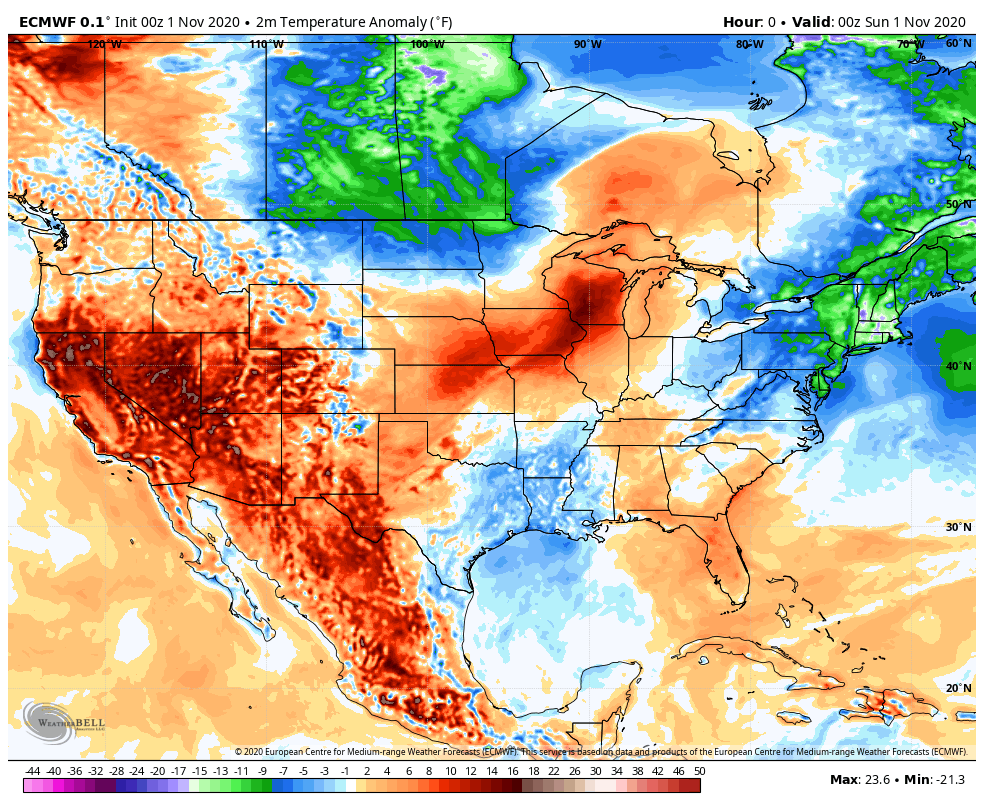
Hang in there NWI, today’s cold air will be short-lived as a large scale pattern change takes place across the United States. A ridge of high pressure will set up shop to our east beginning Tuesday and will bring a prolonged dose of warmer air to the Region beginning Wednesday. Take a look at the high temps compared to average this week–the blues are below average and the reds are above average. An expansive area of above-average warmth is on the way!
We’ll also see quite a bit of sunshine this week and although it doesn’t quite top the few week’s of beautiful weather we had back in September, our guess is this will be our best week of weather this month!
