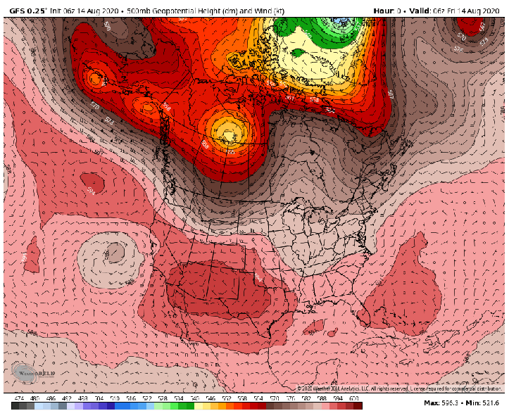
We’ve enjoyed a zonal flow across the US over the past two weeks with rather quick-moving storm systems across the northern Plains into Canada and balanced heat from west to east.
That’s all about to change as a large ridge develops across the western US. The ridge will allow soaring heat all the way up into the Pacific Northwest while the desert and southern California bakes with highs into the 110’s every day for at least the next week.
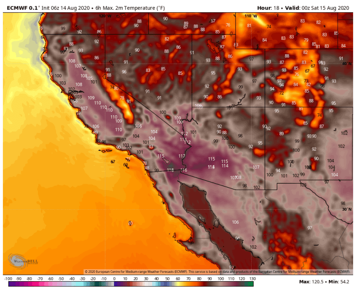
Here are today’s projected highs in the southwest. Yikes! While 100s are common this time of year, 110s are not.
It’ll be dry too as this ridge cuts off any monsoon moisture so wildfires are likely to continue and get worse over the upcoming week. Take a look at the latest drought monitor which paints much of the US under some sort of drought:

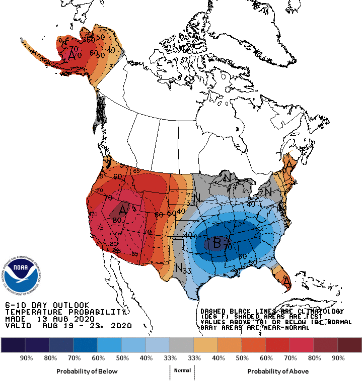
What goes up must come down and that will be the case with the ridge. While the west roasts, we’ll enjoy a more consistent airflow out of Canada and the northwest bringing temps near or below average next week. Our overnight lows will get back into the comfortable range with 50s likely at least a day or two next week. This will also pose to be a dry pattern for us locally as well so any drought concerns across the Region won’t be helped.
As we look towards the next 10-14 days, the ridge will more than likely come east bringing heat back to the central Plains and Midwest. Notice the increasing frequency of cooler air moving into Canada–a true sign that Fall isn’t far off.