
We’ve been talking a lot about these “clusters” of storms roaming the Midwest over the last few days on the eastern fringe of a ridge of heat in the southern Plains. Today will likely be our turn to get into the action as one of these clusters will likely roll through northern Illinois and spread into the Region. With plenty of daytime heating, plenty of humidity, and a high amount of instability, any storms that do get going will be quite potent.

This particular complex of storms that we’re watching is already ongoing across portions of Iowa and has brought damaging winds, heavy rain, and lots of lightning this morning. You can see it develop last night across South Dakota and watch it push into Iowa this morning.
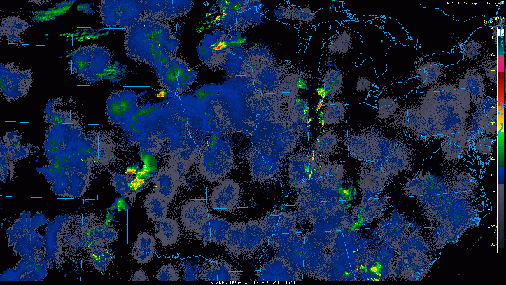
While it has some southeastern movement to it (which would miss us), I’m expecting more development on the northern end early this afternoon (northern Iowa and western Illinois) that WE would be watching for arrival in NW Indiana.
Here’s a likely scenario of the complex of storms this afternoon into the evening:

The Storm Prediction Center has highlighted much of north-central Illinois in the Enhanced Risk (or widespread) for severe weather while we remain in the Slight Risk(or likely) category for some of these stronger storms.

The primary threat with these by far will be damaging winds as these likely form into line segments capable of strong winds. A tornado and hail can’t be ruled out, but that threat is mainly west of us.
In terms of timing, it depends on how the entire system evolves, but beginning early this afternoon we’ll have to keep an eye on how this comes together. Our storm threat will likely be a “one-and-done” with this with a severe threat attached to the main line of storms itself and only to that line.
As always, we’ll keep you up to date on our storms right here and on our Facebook Page as necessary.
