
As we mentioned in this morning’s post (Refreshing Tuesday Ahead), the combination of Tropical Storm Isaias and the area of low pressure responsible for our rain the last few days will help pull in an unseasonably cool airmass from Canada. We’ve already been feeling the changes as humidity has tanked and refreshing air continues to move into the Region!
Tonight we’ll see an area of high pressure settle overhead. This will allow for winds to ease and skies to continue to clear out. That’s the recipe for maximum cooling and we’ll certainly see that tonight with numerous locations near 50 and even some in the upper 40s by daybreak!
Keep in mind, our lowest temps typically occur right before that sun rises (5:48am Wednesday morning) and with our lake water sitting in the 60s and 70s, our coolest locations will be well away from the lake and towards the center of the high pressure. Newton and Jasper counties, we’re talking to you!
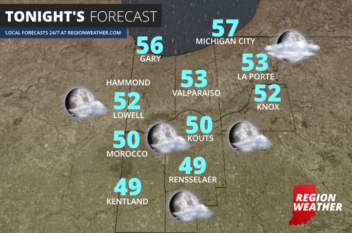
Here is a look at our forecasted low temps tonight:
You wouldn’t expect this to last long in early August and it won’t. Just as quickly as the humidity went out–it will come back in over the next few days with temps heading back into the 80s. Here’s a look at the dewpoint, or how muggy it feels outside, the next few days:

This will also serve to increase our shower and storm chances this weekend! As always, we’ll have any updates for you right here and/or on our Facebook page found HERE
