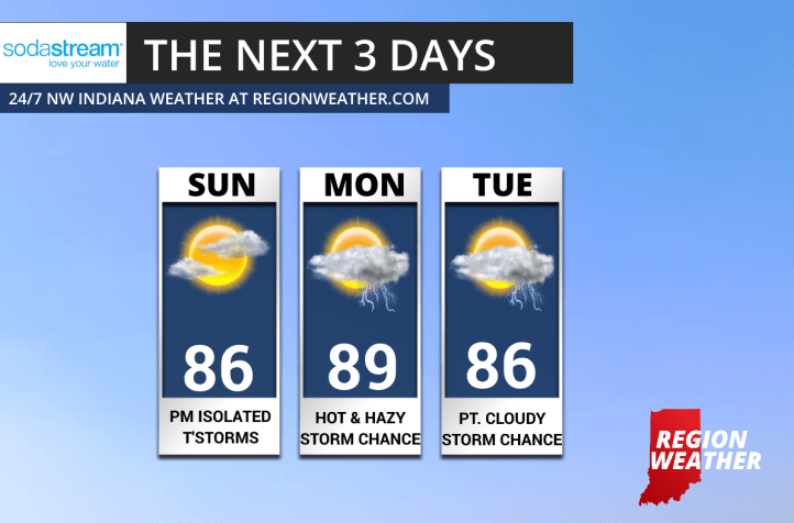
SUMMERY PATTERN:
Pretty much a carbon copy forecast over the next few days with summer-like temps in the mid to upper 80s and daily thunderstorm chances due to a lingering frontal boundary just south of the Region.
While most hours will be dry, storm development will hinge greatly on where storms developed the day before as they put out boundaries that help develop storms the next day.
Here’s a look at the next 3 days: