After a rather uneventful Thanksgiving weather-wise, our next storm is on the way. If you’re shopping from home today, please consider supporting our new sponsors for the month of December: Macys at SouthLake Mall and SodaStream both of which have Black Friday deals in full force! Okay, let’s chat weather:
On the heels of the mid-week wind-maker, our next storm system is already taking shape across the central Plains after bringing rain, wind, and heavy mountain snow to the western US. We’ll once again be on the warmer side of this storm (typical for November) with another rainy wind machine on the way before we turn colder and turn some of the rain to snow on Sunday.
It’s a different story for a large portion of the United States. This storm is going to put down some serious snow for a large geographical area of the country. On the southern end, severe weather and a tornado threat will be possible. Let’s take a closer look at the setup and local impacts of this storm with our
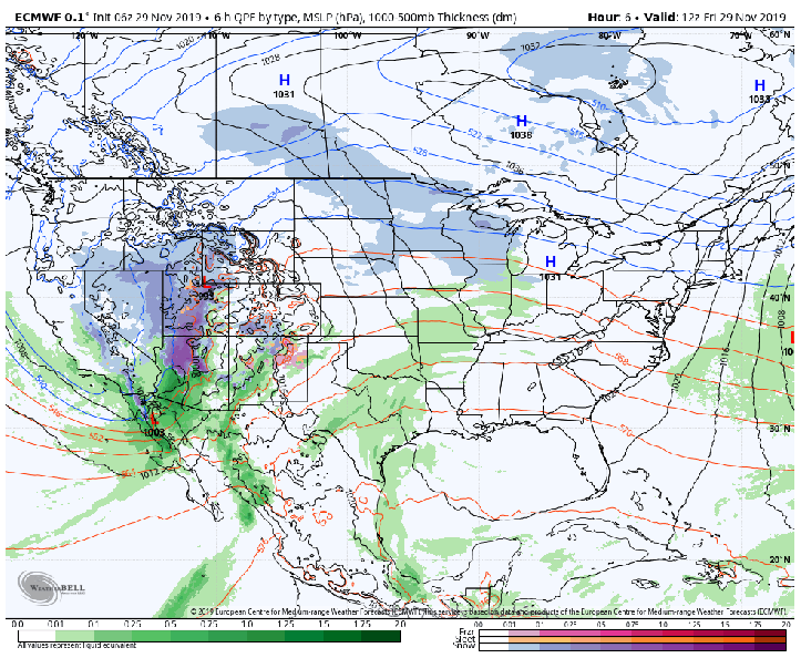
The heavy snow will fall in two main sections of the US. The Rockies into the central and northern Plains will see a large area that receives over a foot of snow. Another bulls-eye will develop in the northeastern US with disruptive snowfall of over a foot for portions of New England late this weekend.
Locally, our clouds will continue to thicken with scattered showers today (Friday). By Saturday the main part of the storm will move in bringing rounds of showers with a few pockets of heavier rain. The wind will begin to ramp up as the low pressure approaches. 
By Sunday, we’ll be on the back side of the storm system and temps will tumble with a nice period of dry weather. Then the moisture returns with rain changing with and changing over to wet snow for many of us. By Sunday night into Monday, leftover lake effect snow (mixed with rain) will end and we’ll enjoy a brief, quiet pattern across the Region. But certainly an impressive storm! Here’s another look at it:

The heaviest snow remains well north:
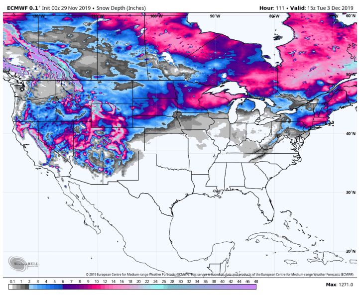
We’re certainly laying the foundation for what could be a cold winter around here. Look at the amount of snow in the US after this system moves through–we’re one of the only spots without a decent snowpack! Remember cold air easily slides from northern Canada across snowpack. Only time will tell!