
*UPDATES: As usual, we’ll be posting the latest updates, your reports and pictures, and important information on our Facebook page Region Weather tonight, tomorrow, and all winter long to keep you up-to-date on local, NWI weather information. Make sure you like and follow us so we show up in your feed!*
THE SETUP
Whether we like to admit it or not, it’s here. Winter weather has arrived in northwest Indiana. Cold air will filter into the Region tonight while a storm system brings moisture into that colder air setting the stage for an accumulating snowfall for ALL of northwest Indiana. Let’s take a look at the setup.
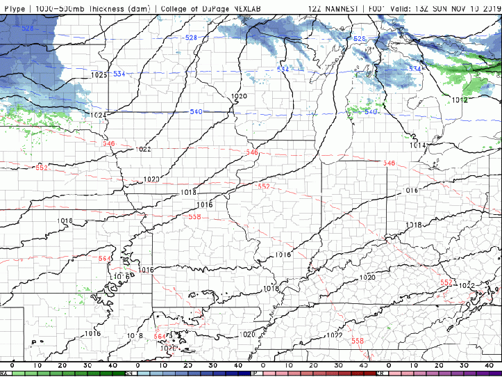
THE BIG PICTURE
As cold air sinks south, an area of low pressure will develop well to our south helping an area of precip to develop with showers quickly transitioning to snow in the Region. Snow will likely fall at a steady light to moderate clip beginning early Monday morning and continuing through early afternoon. We may have a band of lake effect snow WITHIN the snow from the system helping to produce a localized corridor of heavier snow that may target Chicago and Lake County at first if it can develop.
As we go throughout the afternoon, the snow from the storm system will begin to head east, but lake effect snow will likely be on-going from Lake County at first, moving into Porter and La Porte counties through Monday evening. The lake effect snow will set up in La Porte and Porter counties through the overnight before winding down as we head through our Tuesday with drier air moving in and a shift of the winds.
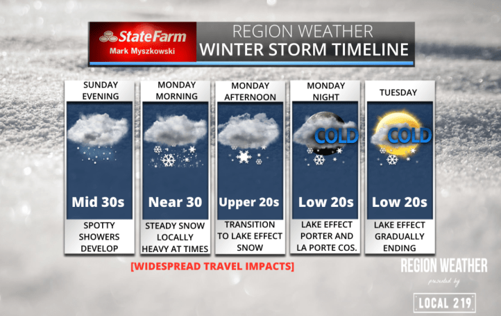
STORM TIMELINE
Your Mark Myszkowski State Farm timeline has showers develop Sunday evening into the early morning hours. Rain will changeover and transition to a steady snow early Monday with a steady snow (locally heavy if a lake effect band can set up) continuing through late Monday. Lake effect takes over beyond Monday afternoon for our eastern counties before winding down Tuesday.
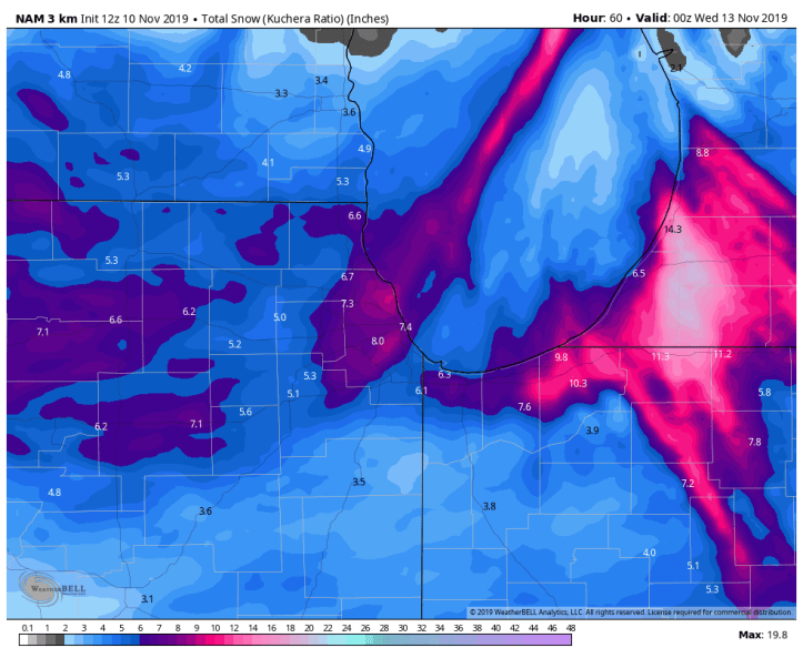
SNOWFALL FORECAST
A general 2-4 inches of snow can be expected for everyone NOT including lake effect snow. Lake effect snow will likely bring an additional 2-4 (and locally more) to portions of Lake, Porter, and La Porte counties. We’ll see even higher snow totals in SW lower Michigan where the lake effect will be well established Tuesday. Storm totals will likely fall in the 4-8 inch range in our lakeshore counties with higher amounts possible where lake effect snow bands persist.
Regional snowfall potential:

Local snowfall potential:
BITTERLY COLD TEMPS
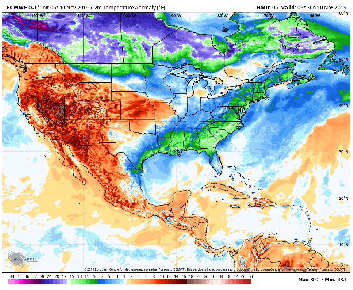
This storm system is also bringing unseasonably cold air with wind chills BELOW zero possible Tuesday morning. While this isn’t uncommon in winter months, we’re still in early November so it’ll be a bit of a shock to the system. Take a look at some of the wind chills out the door Tuesday morning:

This dose of air is incredibly cold for early November! In fact, it will be 20-35 degrees below average for much of the eastern US. If this were a comparably warm airmass, we’d be seeing temps in the 70s and 80s! Look at the large area of the country that will experience well below average temps (purple colors):
We’ll pass along another update this evening with the latest models runs out ahead of our impactful Monday ahead.
