
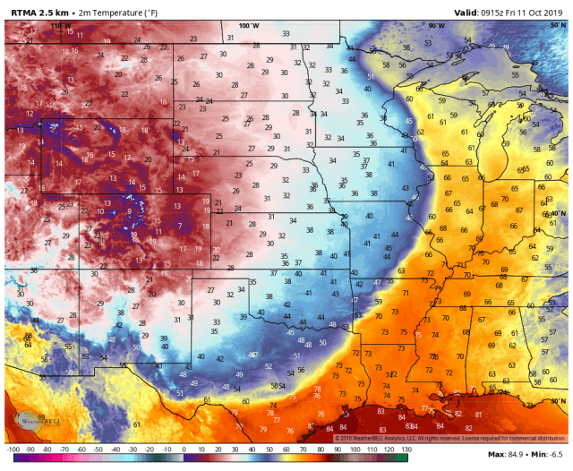
Record-setting cold continues east–look at how the cold, dense airmass moves right through the warmth (and some humidity) we’ve had over the last few days.
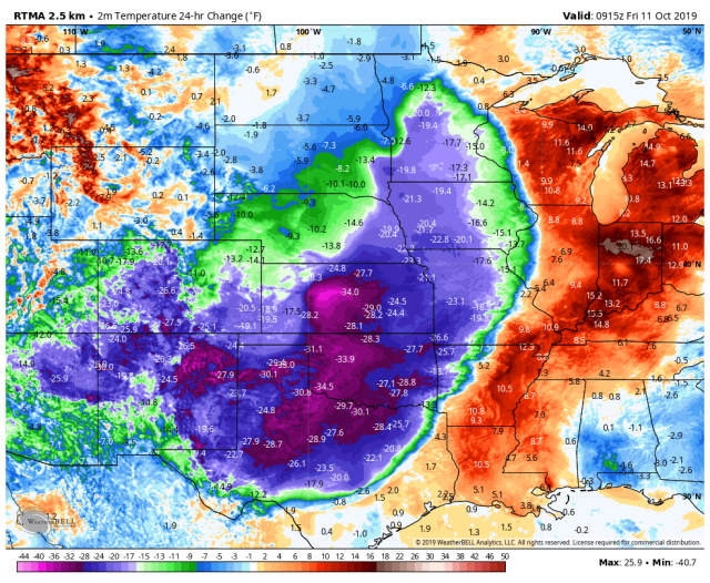
This cold air is changing temps by some 30-40 degrees in a 24 hour period. Not record-breaking, but certainly a noticeable change! It’s fall.
Denver, Colorado set a new record low of 9 degrees this morning. They absolutely destroyed the old record low of 22 degrees–amazing stuff! This cold air is now here and we’ll see the first freeze of the season tonight, frost for others away from Lake Michigan.
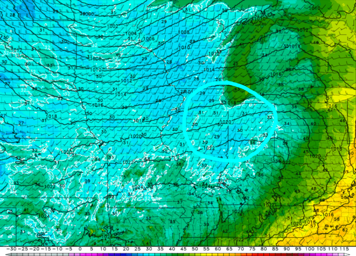
The area of low pressure will continue to spin to our north over the weekend rather than progress eastward. The combination of this strong low and a high pressure system will put the squeeze play on us here in the Region. We’ll see a streak of strong winds rush through Indiana Saturday afternoon creating wind gusts to 40 mph at times! Gusty winds will remain on Sunday, but the strongest look to take place Saturday afternoon.
Beyond this weekend, this pattern may repeat itself in a little over a week as another strong front sends a cold airmass into the western US from Canada. It looks to create a quick warm up for much of the eastern US. The same pattern is likely to repeat with some sort of large temp swing as the cold air rushes east. At least no snow quite yet for us, but the snowpack will be building in Canada as expected. 
