
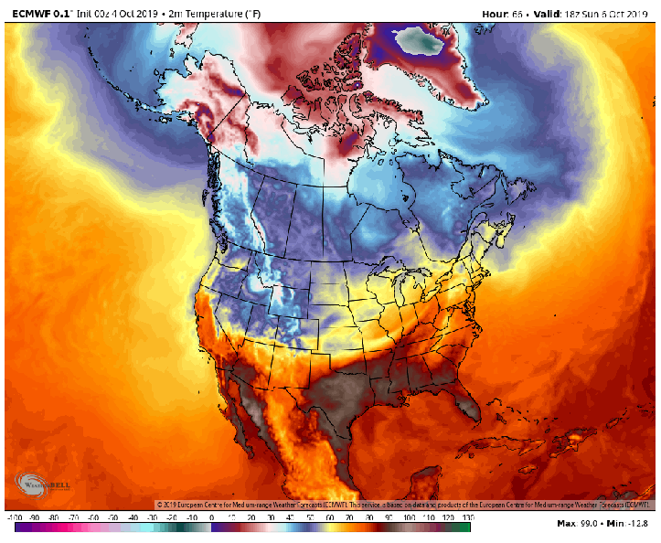
The cold air continues to build in northern Canada–typical for this time of the year–but a series of cold fronts look to gather this cold and bring it south into the US as we head into next week. Remember last weeks snowstorm in the northern Rockies? This has helped lay a healthy snowpack north and west of us which makes it easier for any cold air to make it here this time of year. Let’s take a look at how this may play out.
Watch how the cold builds in northern Canada and then unloads on the upper Midwest and eventually the Great Lakes:
This will more than likely spin up a storm system that will bring a line of showers and storms through the Region at some point mid to late week.

Here’s the latest GFS painting the same picture:
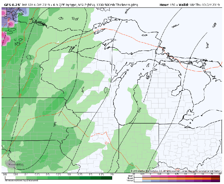
Notice the snowflakes are a bit closer to us with the GFS–this will sort itself out over the upcoming days–wouldn’t be surprised to see some moderation of the temps given the way the models have been the last few weeks, but we’ll see!
