
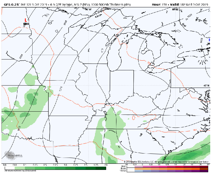
There are signs that we’ll have another cold air intrusion by the middle of next week that will spin up some sort of storm system. Surprisingly, the majority of the models have latched on to the idea–but the details still need sorted out. Take a look at the picture that the GFS is painting as the system spins up in the central Plains bringing storms on the leading edge and an area of snow on the back side.
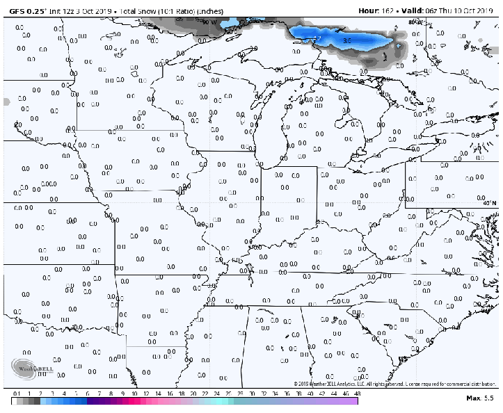
And the accumulations in Wisconsin followed by some lake effect snow chances for areas of Michigan:
It’s still WAY too early to put any stock in these–just interesting to see and a trend we’ll need to watch as we head into next week! We’ll keep you updated!
