
News flash: It’s late July.
It gets hot around here at times…and the next few days will definitely live up to the hype.
We’re all about keeping it real and putting things into perspective here at Region Weather so while we won’t over-hype these hot temps, it IS important to remember that hot temps, with no relief at night, can be dangerous to those who can’t get into air conditioned air…so please be smart, be safe, and stay hydrated.
Let’s talk numbers. A large dome of heat (typical for summer) will move in Thursday as the remnants of Barry move into the northeastern US. Temps will reach into the 90s Thursday and combined with the thick humidity (and the rain from Barry was no help–it’ll make it feel even thicker outside) we’ll see heat indices climb into the low 100s.
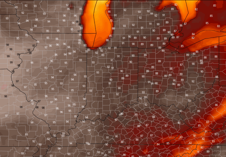
Thursday highs per the Euro (I think we can add a degree or two):
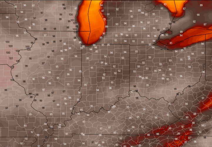
By Friday, this ridge will be in full force over the Region. I think this will be our hottest day. Here are the Euro numbers–again, I think we can add a few degrees, but let’s just look at the EXTENT of this heat:
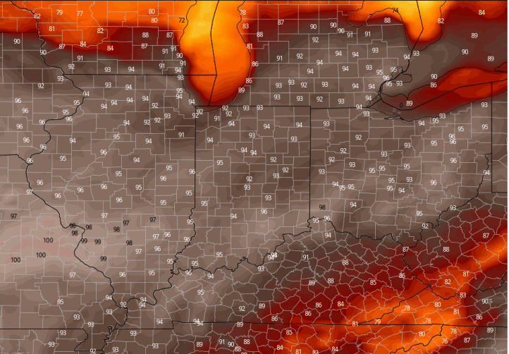
Saturday we’ll begin to see thunderstorm clusters along the periphery of this ridge–they’ll start to put a dent into the heat on the extreme northern end. Still a scorcher here:

And here we go–the relief starts to work south Sunday and the ridge heads west to the 4 corners region where it belongs this time of year. Still one last hot day during this stretch:
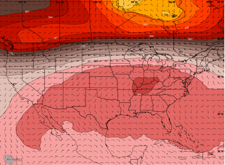
We can also look at the upper levels of our atmosphere that dictate where the airmasses move to and from–you’ll notice the large ridge (and storm track) well north of here during the heatwave. Look at the large dome of hot air that sets up:
THANKFULLY, we’ll see some nice relief next week. Models even bring cooler than average air in here, so we go from one extreme to another…perhaps. I have a feeling the trend will modify a bit next week and it won’t be quite as cool–but it will feel MUCH nicer regardless of the exact numbers:

Making matters worse will be, not just the humidity, but the THICK humidity that will be around here during the next few days. The moisture may help to keep our temps down a degree or two over where they could be had this been a drier airmass. Either way, it will feel very uncomfortable with heat indices pushing 110 at times. We’ll keep you posted on our FB page found here.
