
Thursday was a busy day across the Region as numerous thunderstorms developed during the midday-early afternoon timeframe as a strong storm system moved into the Region. Given the high amounts of wind shear present with this storm, several storms become supercellular, bringing a tornado potential with them as they moved east. A brief EF-0 tornado occurred near Lowell, Indiana as the result of one of the storms. In addition, very cold air aloft resulted in multiple hail reports from the storms. Beyond the storms, strong non-thunderstorms winds followed through the afternoon and evening.
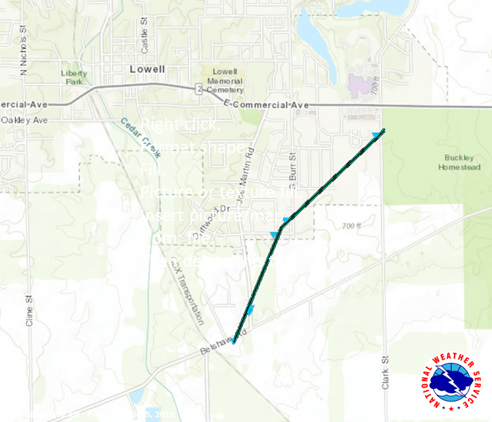
Here is the track of the EF-0 Tornado per the NWS survey:
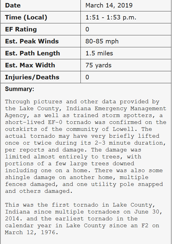
Here are the stats from the surveyed damage:
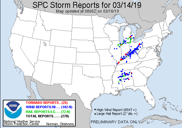
It was an active day across the entire eastern US as severe weather was reported in three main streaks–one through the Region, a second cluster of severe storms from Kentucky to Ohio, and a third in Mississippi and Alabama.
Max Gzik, a Region resident, shared these pictures he captured of the funnel as it approached Kouts:

He then tracked down some damage to a roof and to a house from a falling tree:


This was the first tornado in Lake County since June 30th, 2014 and was the earliest tornado in the calendar year in Lake County since March 12, 1976.
