
Today marks the 5 year mark since a severe weather outbreak produced 136 tornadoes and nearly 800 severe weather reports across the Midwest and Ohio Valley with a powerful late fall storm system. 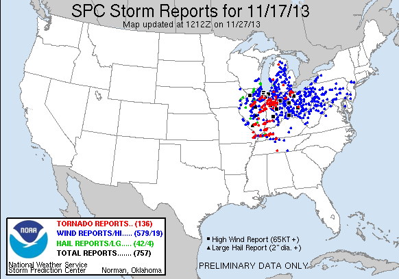
This was during the humble beginnings of Region Weather and I remember it being one of the first “active” severe weather coverage days that have continued over the years. The Storm Prediction Center upgraded us to a “high risk” that day–rarely used anywhere in the US throughout the year. Here’s our post:
And look at that radar! We’ve come a long way:

By the end of the day, tornadoes touched down in Illinois, Indiana, Missouri, Kentucky, and Ohio. Wind damage was significant as well. Here are the regional reports: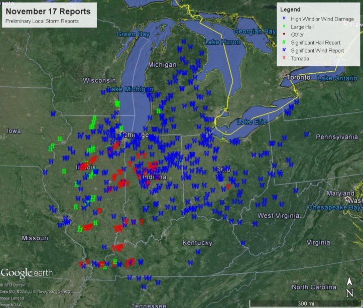
Locally, we had two EF-1 tornadoes–one that crossed from southern Newton County into southern Jasper county and another from a separate storm northeast of Rensselaer in Jasper County:

It’s a reminder that we can and do get severe weather this time of year–it’s also a reason why we can appreciate the colder air we’ve had recently. There’s NO way you’ll see any severe weather in our current pattern as we’ve completely cut off the Gulf of Mexico and any warmth or humidity. For now…
