
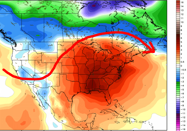
Our recent cold streak (or cool streak depending on how long you’ve lived here) will continue into next week as we get a strong, reinforcing shot of cold air into much of the Eastern US Monday and Tuesday. The jetstream shows the ridge in the west which allows the cold air that’s been bottling up in Canada for over a week to slide down into the Midwest and eastern US:

I’m seeing signs that our pattern will flip back to more mild air later this month–just in time for Thanksgiving. Now notice I didn’t say “warm”–just mild! The jetstream looks to relax a bit and will likely bring a more Pacific brand of air into the Region–40s and some 50s will likely be common. The map below shows the departure from average, so don’t be fooled by the red, it’s only 3-6 degrees above average, which would put us in the 40s and 50s at this point in time!
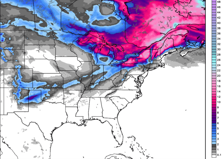
But boy oh boy are we putting down a snowpack in southern and especially southeastern Canada. Here’s the projected snowfall over the next 10 days. Notice the Great Lakes are activated with potentially heavy lake snows and New England gets socked by this storm early next week. Remember snowpack easily allows cold air to slide from northern Canada into the US–something to keep an eye on in the Midwest and eastern US with that snow sitting there!
As always, we’ll continue to follow the trends and pass our thoughts along to you all winter long!
