
Just wanted to send a quick update on what has become an active Atlantic Ocean this week. Hurricane season usually “peaks” between September 8-12th, so this is right on cue. Let’s take a look at what’s happening as of Saturday afternoon.
TROPICAL STORM HELENE
Helene will likely become a hurricane Sunday, but the steering flow is expected to take Helene on a track to the northwest. As of now, Helene is not expected to be a threat to the US.

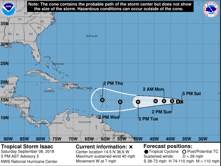
TROPICAL STORM ISAAC
Isaac is expected to become a stronger tropical storm and then eventually a hurricane as we begin next week. The path takes it almost due west into the Windward Islands and that’s ALWAYS a storm location that we need to watch for potential impacts on the US. Isaac likely wouldn’t be a threat to the US until next weekend and the following week.
TROPICAL STORM FLORENCE
Florence is the storm to watch. Never in our recorded history has a storm taken the track that Florence seems set on with it’s further north latitude and westward movement and models don’t have a great handle on it this far out–they rarely ever do. That being said, Florence is expected to regain hurricane status late tonight (Saturday night) into Sunday and strengthen into a potential major hurricane over the next few days. Impact potential on the US is high and stretches anywhere from northern Florida to New England. The consensus among the models right now take Florence into the Carolinas sometime late next week, but again, that could change. Stay tuned!

